An official website of the United States government
Here's how you know
Official websites use .gov
A .gov website belongs to an official government organization in the United States.
Secure .gov websites use HTTPS
A lock () or https:// means you’ve safely connected to the .gov website. Share sensitive information only on official, secure websites.
A telephoto view of the front of an ‘A‘ā flow near the base of the pali, producing head shimmer in the center of the photo. Rubble from the flow rolls downhill, as the molten center slowly pushes forward.
A geologist documents a flowing ‘A‘ā channel that twists down the pali (from upper right to lower left). The center of the channel in the photo is mostly obscured by levees of rubbly ‘A‘ā, pushed to the edges as the lava flowed. At the bottom left, the levee has not built up as high, so some molten lava from the channel is exposed.
A telephoto image of a section of one of the smaller ‘A‘ā channels which is roughly 1 m (yard) wide. The channel feeds the slow-moving, rubbly front as it pushes forward. A small accretionary lava ball travels down the lava channel.
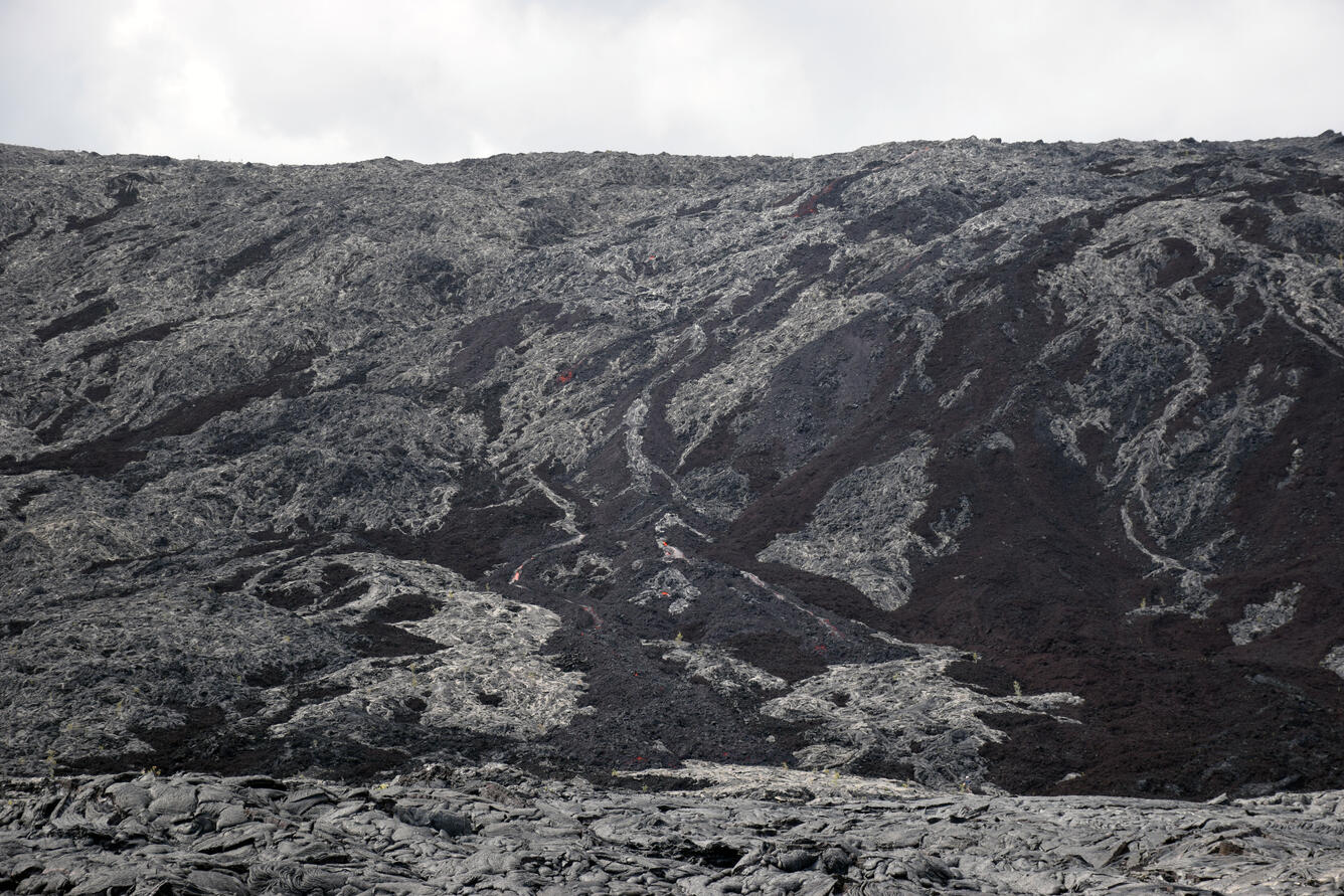
‘A‘ā flowing down Pulama pali in multiple small channels, with orange incandescence visible. Older ‘A‘ā that is more red-brown in color (right) predates the episode 61g flow, while the active ‘A‘ā (photo's center) extends from the top to the base of the pali's steeper section. The closest active breakouts that geologists could find, were scattered pāhoehoe breakouts approximately 3.3 km (2.1 miles) from the emergency road. This section of the pali is one of several that have had active breakouts and lava channels over the past few days.