An official website of the United States government
Here's how you know
Official websites use .gov
A .gov website belongs to an official government organization in the United States.
Secure .gov websites use HTTPS
A lock () or https:// means you’ve safely connected to the .gov website. Share sensitive information only on official, secure websites.
This animated GIF shows a pair of radar amplitude images that were acquired by the Italian Space Agency's Cosmo-SkyMed satellite system. The images illustrate changes to the caldera area of Kīlauea Volcano that occurred between May 23 at 6:00 p.m. HST and May 31 at 6:00 p.m. HST. The satellite transmits a radar signal at the surface and measures the strength of the return, with bright areas indicating a strong return and dark areas a weak return. Strong returns indicate rough surfaces or slopes that point back at the radar, while weak returns come from smooth surfaces or slopes angled away from the radar.The expansion of the summit eruptive vent within Halema‘uma‘u crater is clear, but differences between the images also indicate widening of Halema‘uma‘u itself, especially along the crater's southeast edge. These changes are a consequence of rockfall into the growing summit eruptive vent, which is probably floored by rubble.
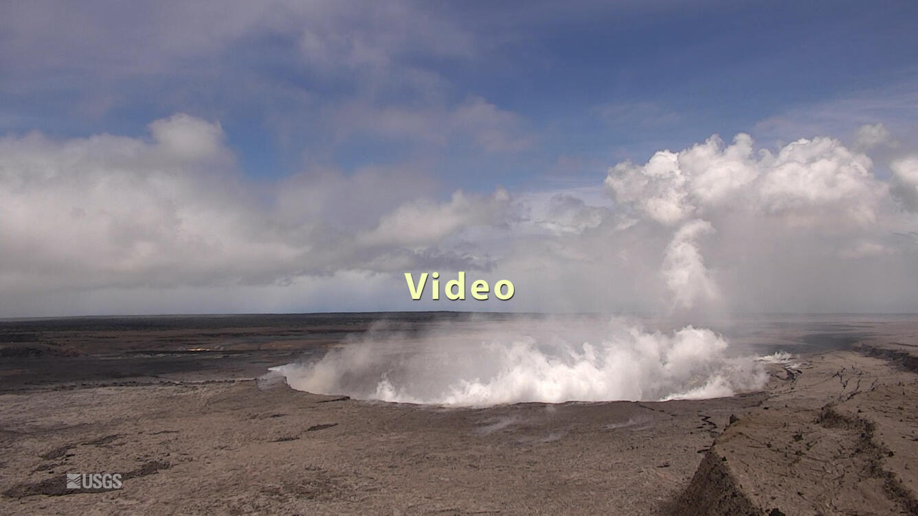
UAS mission films details of changes occurring within Halema‘uma‘u crater at Kīlauea's summit
A UAS mission on May 31, 2018, filmed details of the dramatic changes occurring within Halema‘uma‘u crater at Kīlauea's summit since explosive eruptions of ash and gas and ongoing wall collapse began in mid-May. Clearly visible are the steep, and in places, overhung crater walls, new cracks and faults that reflect ongoing subsidence of the area and intense steaming from a new collapse pit on the north margin of Halema‘uma‘u. Footage also shows yellow sulfur precipitate on the rubble-covered floor and a scattering of large ballistic blocks around the crater rim. This video was taken from a UAS (Unmanned Aircraft Systems). Limited UAS flights into this hazardous area are conducted with permission and coordination with Hawai‘i Volcanoes National Park. The overflights collect visual information on what is happening at this rapidly changing eruption site. Scientists will be examining the footage in detail to understand how the expanding collapse area is evolving, the extent of ballistic debris, and other clues as to what is happening at Kīlauea's summit. This information informs assessment of hazards, which is shared with the National Park Service and emergency managers. Video by the U.S. Geological Survey and Office of Aviation Services, Department of the Interior, with support from the Hawaiian Volcano Observatory and Hawai‘i Volcanoes National Park.
Fissure 8 continues to feed lava into multiple flow lobes. One lobe is advancing through agricultural lands toward the northeast, as shown in this image taken from a helicopter overflight on June 1, 2018, at 6:21 AM.
Photo of the easternmost Fissure 8 lava flow in the vicinity of Kapoho Crater at 6:00 AM HST on June 1. This lava flow field has been advancing at about 80 yards/hour, and at 7AM was about 0.85 miles west of the Four Corners intersection.
Fissure 7 and 8 viewed from the intersection of Nohea and Leilani Streets
Viewed from the intersection of Nohea and Leilani Streets at 10:15AM HST on June 1, the Fissure 8 lava fountain (to the right) appears to have decreased in height from previous sustained heights of 260 feet. To the left, Fissure 7 appears to be showing renewed outgassing.