U.S. flag

An official website of the United States government

March 30, 2022

An eruption at Kīlauea's summit began at approximately 3:20 p.m. HST on September 29, 2021. Intermittent lava activity is confined within Halema‘uma‘u crater, in the closed area of Hawai‘i Volcanoes National Park.

HVO scientists collect detailed data to assess hazards and understand how the eruption is evolving at Kīlauea's summit, all of which are shared with the National Park Service and emergency managers. Access to this hazardous area is by permission from, and in coordination with, Hawai‘i Volcanoes National Park.

March 30, 2022 — Kīlauea summit activity

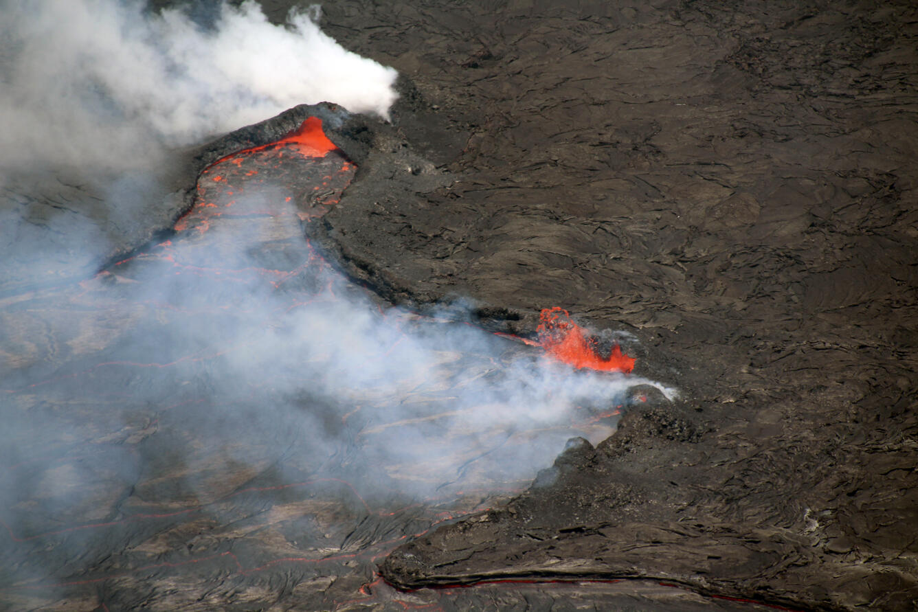
Color photograph of lava lake
Activity continues within Halema‘uma‘u crater, at the summit of Kīlauea. In this telephoto view looking north, minor spattering is apparent on the eastern (left) margin of the active lava lake area. Lava lake circulation primarily goes from west to east (left to right), and sometimes lava spatters up when it encounters the active lake margin, as shown on this photo. USGS image by N. Deligne.
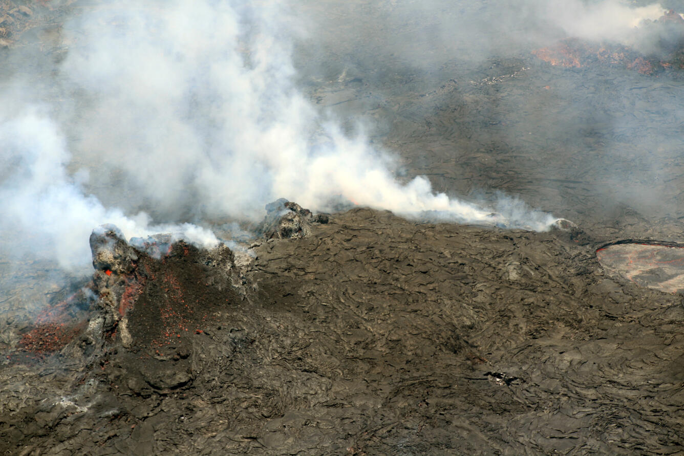
Color photograph of volcanic vent
Telephoto view, looking north, of the remnants of the west vent cone area within Halema‘uma‘u at the summit of Kīlauea on March 30, 2022. Lava is visible through a small opening near the top of the larger left remnant, indicating there is lava within. The western extent of the active lava lake area is visible in the center right of the image. USGS image by N. Deligne.

March 29, 2022 — Kīlauea summit overflight

Activity continues in Halema‘uma‘u crater, at the summit of Kīlauea. Today, spattering was present at the margin of the active lava lake, along with lava pouring from a small cone in the northeast portion of the crater floor. The video ends with crustal foundering in an area of ponded lava in the central portion of the crater floor. 
This video, captured by a webcam on the northwest rim of Kīlauea caldera of March 29, 2022, shows spattering from a cone that has developed on the crater surface in the eastern part of Halema‘uma‘u. The presence of these features demonstrates that molten material is present beneath the solidified surface of the crater floor. 
Color photograph of lava lake
A photograph taken during a helicopter overflight on the morning of March 29, 2022, shows an overview of Halema‘uma‘u looking northwest. The active lava lake is visible on the left, and a small lava flow east (right) of the main island is apparent in the center. Much of the crater floor is dark grey to silvery (as opposed to black), indicating it has been recently been covered by lava flows, mostly likely from large sustained oozeouts occurring over the past five days. In the foreground to the left, Crater Rim Drive (closed to the public) is visible—this portion of the road previously led to the Halema‘uma‘u Overlook parking lot, which was destroyed during the 2018 Kīlauea summit collapse. USGS image by N. Deligne. 
Color photograph of volcanic landscape
A photograph taken during a helicopter overflight on the morning of March 29, 2022, with views of Kīlauea Iki Crater (top left), Pu‘upua‘i (left), and Keanakāko‘i Crater (bottom right). Pu‘upua‘i is a large cinder cone that during the 1959 eruption of Kīlauea Iki. The trail leading to a popular viewing area for the current eruption is visible in the bottom center. Part of the fissures of the July 1974 eruption are also visible on the bottom right. USGS image by N. Deligne.
Color photograph of volcanic landscape
A telephoto view looking southwest taken during a helicopter overflight on the morning of March 29, 2022, of the Kamakaiʻa Hills of Kīlauea's Southwest Rift Zone. Geologic mapping efforts indicate that the Kamakaiʻa Hills likely erupted within the last 250 years. The southwest flank of Mauna Loa is faint in the distant background to the right. USGS photo by N. Deligne.

March 25, 2022 — Kīlauea summit activity

The summit eruption in Halema‘uma‘u crater, at the summit of Kīlauea, continues with lava lake activity. This video, taken on March 24, 2022, shows lava from the main lake pouring into a smaller lake in the western portion of the crater. 

March 22, 2022 — Keller Well sampling

Color photograph of scientists in field
Located south of Halema‘uma‘u crater, in Kīlauea south caldera region, the Keller Well is a borehole drilled in 1973 to a depth of 4,140 ft (1,262 m). Hawaii Volcano Observatory geologists measure the depth to the water table quarterly to monitor Kīlauea summit region hydrology. Photo taken on March 22, 2022, by F. Younger.
Color photograph of scientists in field
On March 22, USGS Hawaiian Volcano Observatory Scientists measured the water level in Keller Well, located in Kīlauea's south caldera region. Scientists also obtained a water sample. Keller Well is measured and sampled quarterly to monitor how magma supply to Kīlauea's summit reservoirs might impact regional ground water. For more information on Keller Well monitoring, please see HVO's Dec. 20, 2018, "Volcano Watch" article: Volcano Watch — A Field Trip to the Mountain of Water. USGS image by F. Younger.


Get Our News

These items are in the RSS feed format (Really Simple Syndication) based on categories such as topics, locations, and more. You can install and RSS reader browser extension, software, or use a third-party service to receive immediate news updates depending on the feed that you have added. If you click the feed links below, they may look strange because they are simply XML code. An RSS reader can easily read this code and push out a notification to you when something new is posted to our site.