Volcanic Ash and Pumice Hazards in Long Valley Caldera, California
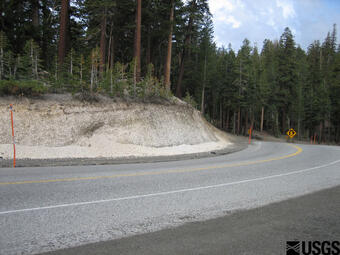
During a typical explosive eruption of a Mono-Inyo vent, tephra (volcanic ash and larger rock fragments) may accumulate near the vent to a thickness of tens of meters (yards).

Areas downwind of an explosive eruption could be covered with a layer of volcanic ash and pumice more than 20 cm (8 in) thick at a distance of 35 km (22 mi) and 5 cm (2 in.) at 85 km (53 mi).
It is not possible now to predict wind direction or directions that will exist at the time of a future explosive eruption. However, records suggest that on an annual basis winds in the area blow toward an east or northeasterly sector more than 50 percent of the time, and toward some easterly direction more than 80 percent of the time. In general, the grain size and thickness of ash accumulations gradually decrease with increasing distance from a vent.
Wind Direction and Speed Affects the Pattern of Ash and Pumice Fallout
Ash darkened the skies above Clark Air Base (U.S. Air Force) in the Philippines for weeks after the eruption of Mount Pinatubo in June 1991. Although the eruption was the world's second largest in the 20th century, the base was blanketed with a layer of pumice and ash only about 10 to 15 cm (about 4 to 6 in) thick at a distance of 20 km (12.4 mi) from Pinatubo. This is about the same thickness of ash that was deposited 15 km (9.3 mi) downwind from an eruption of South Deadman vent in Long Valley about 550 to 650 years ago. This illustrates the way in which wind (direction and speed) affects the pattern of fallout. Both the size of fragments and the thickness of ash and pumice fall downwind from an erupting volcano will vary depending on wind conditions.
During the climactic eruption of Mount Pinatubo on June 15, a strong typhoon moved across the Philippines. The typhoon blew ash and pumice from Pinatubo in all directions near the volcano. In contrast, a strong wind blew in a uniform direction during the much smaller South Deadman eruption in Long Valley.
The hazard zones for ash and pumice fallout from a future eruption in Long Valley represent potential thicknesses downwind based on the size and type of several eruptions that have occurred in the past 5,000 years from the Mono-Inyo chain. Since the actual wind conditions and the location of the vent during the next eruption in the Long Valley area can't be known until the activity begins, the zones include a much larger area than is likely to be effected by ash and pumice fallout from a single eruption.
Tephra hazard-zone maps and illustrations
- For areas within 300 km (185 mi.) of vents.
- Average annual wind directions above Las Vegas, Nevada.
- Tephra descriptions and illustrations.
During a typical explosive eruption of a Mono-Inyo vent, tephra (volcanic ash and larger rock fragments) may accumulate near the vent to a thickness of tens of meters (yards).

Areas downwind of an explosive eruption could be covered with a layer of volcanic ash and pumice more than 20 cm (8 in) thick at a distance of 35 km (22 mi) and 5 cm (2 in.) at 85 km (53 mi).
It is not possible now to predict wind direction or directions that will exist at the time of a future explosive eruption. However, records suggest that on an annual basis winds in the area blow toward an east or northeasterly sector more than 50 percent of the time, and toward some easterly direction more than 80 percent of the time. In general, the grain size and thickness of ash accumulations gradually decrease with increasing distance from a vent.
Wind Direction and Speed Affects the Pattern of Ash and Pumice Fallout
Ash darkened the skies above Clark Air Base (U.S. Air Force) in the Philippines for weeks after the eruption of Mount Pinatubo in June 1991. Although the eruption was the world's second largest in the 20th century, the base was blanketed with a layer of pumice and ash only about 10 to 15 cm (about 4 to 6 in) thick at a distance of 20 km (12.4 mi) from Pinatubo. This is about the same thickness of ash that was deposited 15 km (9.3 mi) downwind from an eruption of South Deadman vent in Long Valley about 550 to 650 years ago. This illustrates the way in which wind (direction and speed) affects the pattern of fallout. Both the size of fragments and the thickness of ash and pumice fall downwind from an erupting volcano will vary depending on wind conditions.
During the climactic eruption of Mount Pinatubo on June 15, a strong typhoon moved across the Philippines. The typhoon blew ash and pumice from Pinatubo in all directions near the volcano. In contrast, a strong wind blew in a uniform direction during the much smaller South Deadman eruption in Long Valley.
The hazard zones for ash and pumice fallout from a future eruption in Long Valley represent potential thicknesses downwind based on the size and type of several eruptions that have occurred in the past 5,000 years from the Mono-Inyo chain. Since the actual wind conditions and the location of the vent during the next eruption in the Long Valley area can't be known until the activity begins, the zones include a much larger area than is likely to be effected by ash and pumice fallout from a single eruption.
Tephra hazard-zone maps and illustrations
- For areas within 300 km (185 mi.) of vents.
- Average annual wind directions above Las Vegas, Nevada.
- Tephra descriptions and illustrations.


