Kacey Garber's NAGT-USGS 2017 Summer Field Training Program
Date: Summer 2017
Project Duration: 12 weeks
Project Location: Reston, VA
Objectives
The objective of this internship was to provide her with an extensive field experience assessing and quantifying geomorphic changes within the floodplain system and to gain computer mapping skills to remotely detect geomorphic changes using lidar and DEM datasets. She assisted with field work, lab work, and data analysis for the two projects described in the background section. The majority of her time was spent on the Delaware River Watershed project due to the intense summer field campaign. The Stormwater Management Practices project will provided her with the opportunity to explore a second project and develop additional skills during downtime. Both projects are led by the same core group of scientists, so this dual role provided an excellent opportunity for her to shadow scientists and gain diverse experience while not being overwhelmed.
Kacey's Tasks
Kacey Garber joined an interdisciplinary research group that included ecologists, hydrologists, geographers, and physical scientists in Reston, VA. She was integrated into two ongoing projects that investigate how land use and land management (e.g., stormwater management) influence stream and floodplain geomorphology and sediment and nutrient export to streams.
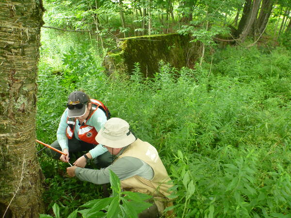
The primary project she was involved in was, “Quantifying Floodplain Ecological Processes and Ecosystem Services in the Delaware River Watershed”. She assisted with field work that involved visiting 15 different site in the Delware River to conduct measurements of stream channel cross sections, bank erosion, and sediment deposition on floodplains and to collect soil samples to determine nutrient content during the summer of 2017. Field datasets were used to quantify floodplain deposition and stream bank erosion rates for sediment and associated nitrogen and phosphorus at each site. She also assisted with a mapping component that uses a GIS Tool and digital elevation models (DEMs) for the study area to map and extract floodplain and stream channel physical characteristics (e.g., bank height, channel width). Together the field and mapping components were used to assess floodplain condition and associated ecosystem services to help target conservation of areas with high ecosystem services values and the restoration of areas that could provide improved ecosystem service benefits.
The second project she assisted with was, “Understanding the Effects of Stormwater Management Practices on Water Quality and Flow”. This project focuses on assessing the impacts of different types and arrangements of stormwater management practices on water quality, stream flow, groundwater levels, and human health (e.g., fecal bacteria). Study watersheds are located in Montgomery
County, MD and consist of a forest reference watershed, a watershed with centralized, detention-focused stormwater management, and a watershed with distributed, infiltration-focused stormwater management. The project links field and lab analyses of geomorphic, water quality, and hydrologic changes in the stream, and watershed mapping of with current and historic land use and stormwater infrastructure.
Results and Benefits
Kacey Garber primarily received mentoring from the two USGS scientists, Dianna Hogan and Krissy Hopkins, but she also interacted with other members of the interdisciplinary project team and actively participate in regular group meetings. She was encouraged to improve her science communication through the development of skills related to data visualization and summarization. She received extensive training and experience with the field, lab, and data analysis methods needed to perform her duties. This experience provided her with an opportunity to explore her interest in the topics of geomorphology, water quality, and ecosystem
services concepts.


