New Product from the 3D Elevation Program: Seamless 1 Meter Digital Elevation Model (S1M)
The Seamless 1-Meter Digital Elevation Model (S1M) is a nationwide, high-resolution elevation dataset that merges trillions of lidar-derived terrain points into a single, continuous elevation surface.
Introducing the Seamless 1 Meter Digital Elevation Model (S1M)
Developed by the USGS 3D Elevation Program (3DEP) and funded by the Inflation Reduction Act (IRA), S1M delivers a combination of unprecedented detail and consistency across the United States.
Built from 3DEP-quality lidar, S1M provides analysis-ready data to support a wide range of applications including:
- Surface water modeling for the 3D Hydrography Program (3DHP), improving accuracy and detail over the National Hydrography Dataset
- Flood risk mapping
- Wildfire behavior modeling in complex terrain
- Surface geology mapping and subsurface extrapolation to support mineral assessments
- Engineering and infrastructure planning
- Storm surge and tsunami modeling for emergency and coastal management
- Precision agriculture, soil conservation, and natural resource management
- 3D visualization, line-of-sight analysis, and cartography
- Countless other applications
What makes the S1M different from existing 3DEP 1-meter DEMs?
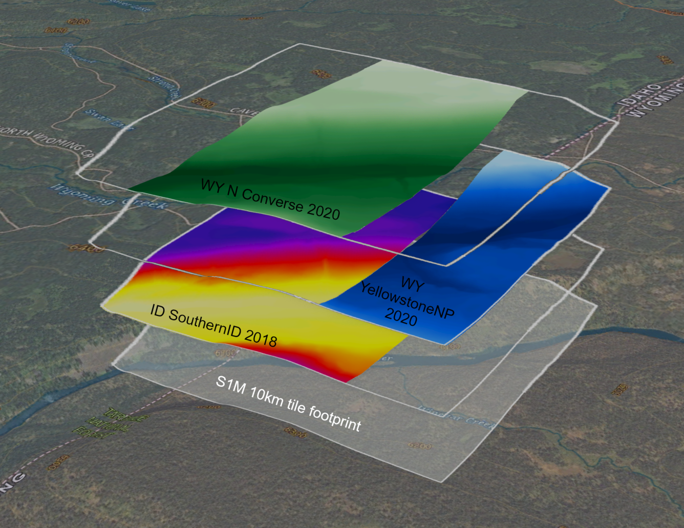
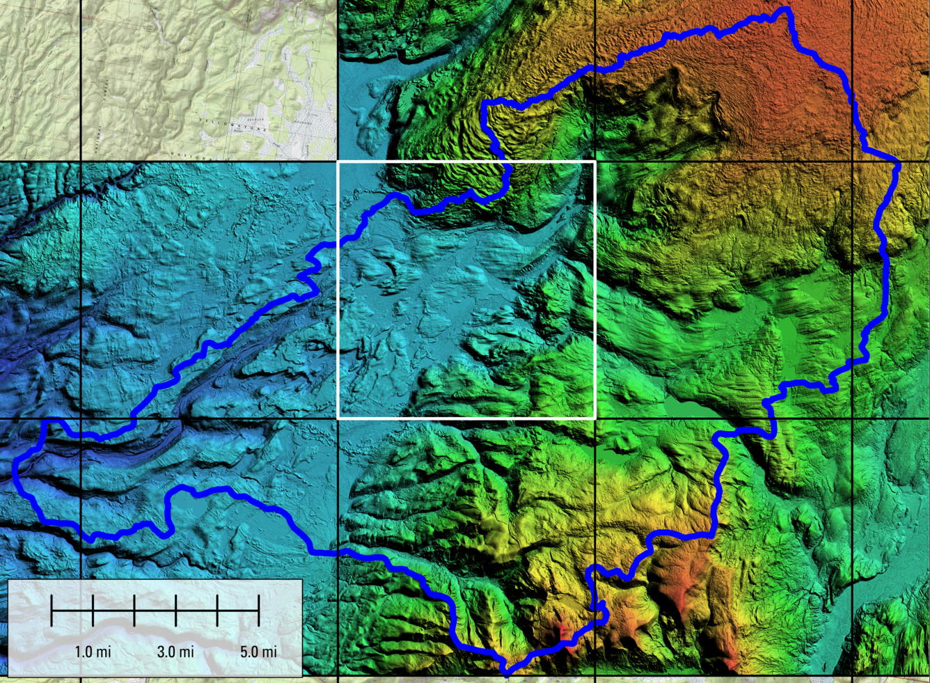
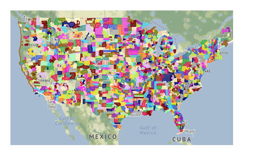
Unlike existing 3DEP 1-meter products, which are published as individual projects, S1M is seamless across project boundaries. USGS scientists developed a sophisticated blending method (Cushing and Tyler, 2024) to merge disparate datasets into a single DEM that:
- Eliminates gaps and slivers between lidar projects caused by inconsistent boundaries
- Reduces mismatches across water surfaces caused by different collection dates
- Avoids data artifacts in elevation models caused by varying coordinate systems and datums
Key features of the S1M DEM:
The Seamless 1-Meter DEM offers technical and practical advantages that make it easier to use, more consistent, and more accessible than previous elevation products. Below are some of the key features of the S1M product:
- Nationwide Coverage in Progress: Production began in 2025, and new tiles are published as they become available. S1M will be produced for all of the continental United States, Hawaii and Puerto Rico.
- Standard and Predictable Extents: S1M is produced in uniform 10 km x 10 km tiles using a tiling scheme based on NAD1983 coordinates. Each tile has a predictable extent and naming convention derived from its coordinate location. All tiles use the same projection which will standardize horizontal and vertical units in meters, making integration with other spatial datasets straightforward.
- Unified Datasets: S1M integrates lidar datasets with different coordinate systems, vertical datums, spatial resolutions, and time periods to eliminate the need for complex geospatial data processing.
- Comprehensive Metadata: S1M is delivered with spatial and textual metadata that details the source data lineage and processing steps that were used to create this seamless product.
- Free and open access: Available on The National Map.