
DOI Remote Sensing Activities 2017 Includes FRESC Research on Lidar to Study Forest Habitat
The Department of the Interior has released a report of the DOI Remote Sensing Activities for 2017, which includes a summary of research that uses Lidar to study forest canopy.
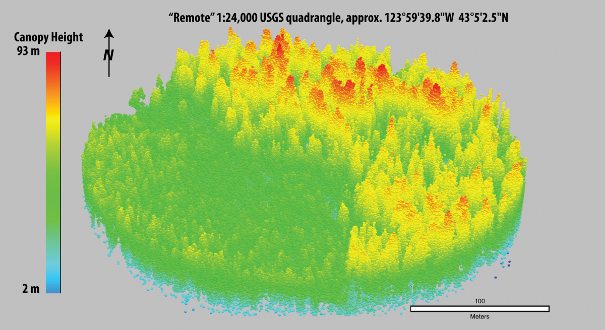
The report was compiled by the DOI Remote Sensing Working Group and is parceled into sections based on individual Bureau activities. The section describing USGS activities contains information about how using Lidar can provide fine-scale, three-dimensional measurements of forest canopy. This information is useful for studying habitat required by wildlife species, such as the marbled murrelet. A synopsis of this research by USGS researchers Joan Hagar and Patti Haggerty can be found here: https://eros.usgs.gov/doi-remote-sensing-activities/2017/lidar-quantifi….
Get Our News
These items are in the RSS feed format (Really Simple Syndication) based on categories such as topics, locations, and more. You can install and RSS reader browser extension, software, or use a third-party service to receive immediate news updates depending on the feed that you have added. If you click the feed links below, they may look strange because they are simply XML code. An RSS reader can easily read this code and push out a notification to you when something new is posted to our site.