An official website of the United States government
Here's how you know
Official websites use .gov
A .gov website belongs to an official government organization in the United States.
Secure .gov websites use HTTPS
A lock () or https:// means you’ve safely connected to the .gov website. Share sensitive information only on official, secure websites.
The latest “Eyes on Earth” podcast is about the 20th anniversary of the International Charter Space and Major Disasters, a global organization made up of 17 member agencies, including the USGS, that provides free of cost satellite imagery for National Disaster Management Agencies to deal with disaster response.
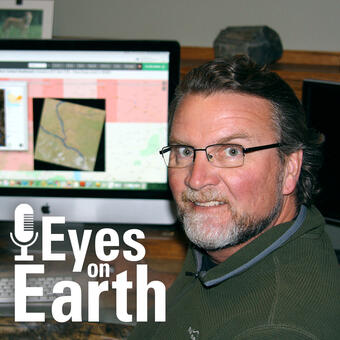
Mike Budde of USGS EROS, pictured with the logo for the USGS EROS podcast "Eyes on Earth."
Mike Budde is the USGS liaison to the International Charter, and he discusses how the Charter has been helping people recover from disasters for the last 20 years.
Here are a few highlights from that conversation.
What kind of disasters are we talking about?
Well, it can be either natural disasters or manmade. So manmade disasters are things like oil spills or industrial accidents. We have had each of those recently with the industrial accident in Lebanon and the oil spill off the coast of Mauritius. But natural disasters by far are the most common. Of the natural disasters, floods are the most common. Floods, earthquakes, volcanic eruptions, fires—all of these are natural disasters that the charter responds to.
And you mentioned 17 members of the charter. Where are these members from?
Well, all over the world, actually. There are two members from the U.S.: USGS and NOAA (National Oceanic and Atmospheric Administration) is a member as well. Then there are members in Brazil, Europe (many parts of Europe actually), Russia, China, Japan, Korea—so really across the globe.
So they are providing this data at no cost for the Charter to use. How does the charter get the data to where it needs to go?
We have kind of an operational system in place. So the way it functions is, there is a request for support. That can come from a national disaster management agency or many different sources. In the U.S., that typically would come from FEMA or the National Guard. And how that works then, we have what are called authorized users. I function in that role for the U.S. I would initiate the activation into our system which would then spawn off a number of actions where the request is evaluated, then there are a number of other roles that need to be filled. So there’s a project manager which really orchestrates the activation from its beginning. That person works both with the person who requested, so works with the authorized user, as well as the end user. So the national emergency management agency that would actually be using the data on the ground. It’s quite a process, but one that we have automated to a great degree so it’s really improved our ability to respond.
I went to the Charter website and looked at a recent activation for a flood in Sudan. There is just a dizzying amount of data available for that activation in particular. It said 261 acquisitions. Is that normal?
At this time, it is. We really do acquire quite a large volume of data for activations. In fact, we have some that have acquired many more than that even. The fires in Australia. There was a dizzying amount of data acquired for that event. And that really comes down to something that is important for the project manager to be able to deal with is sorting through all those data and making sure that the most useful data is being made available to address the issues at hand. So we’ve really done a lot in terms of our automated system that houses those data and allows the user to sort through and filter data sets to get to what they need the most.
The Charter provides at least some way to make it easier for the user to get at what they need.
Yes. So we have what is called COS-2. it’s a Charter Operational System. Once an activation is started all those people involved in working on it have access to this system and are able to view data coming in and view products that are generated by what are called value added providers. We oftentimes will partner with specific groups that analyze data and generate the informational products. Providing the data is one thing but getting actionable information in the hands of the people who need it is a big goal.
Eyes on Earth Episode 36 - International Charter Turns 20
So the Charter has been around for 20 years now. Do you know if there is someone who sort of got the idea started back in the year 2000?
Yes. In 1999 following a UNISPACE Conference there were discussions between the European Space Agency and the French Space Agency CNES, and they are really the two that initiated the Charter from the beginning and they were soon joined by the Canadian Space Agency, so in 2000 the Charter was deemed operational. Since that time as I said 14 more members have joined including the USGS joining in 2005.
How did EROS come to be a part of it then?
Even prior to our involvement in 2005 we had a role during the tsunami in Indonesia in 2004. Brenda Jones, a former employee at USGS, was really instrumental in EROS’ involvement in the Charter and holds a somewhat legendary status among its members. She was very active at the beginning, and she did some organization in support of that tsunami in Indonesia in December of 2004 where Landsat data was used to show the impacts before and after the tsunami event. It was shortly after that, that USGS became an official member of the Charter.
What has changed the most in the last 20 years?
The obvious thing that’s changed is a lot of things that used to be done by email or a telephone call is automated within that operational system. So we are constantly upgrading that COS-2 system to make management of the activation easier and more streamlined.
I imagine computer processing has just gotten faster over time.
It has, and we learn things, more efficient ways of doing things along the way. So that’s been big improvements in our operational side. One thing that we are doing is working on having processing platforms as part of our operational system. So what would happen there is users could actually come to that system, and there would be a platform to interact with the data and be able to actually generate value added products such as flood inundation maps and damage assessment.
Ok, more than just satellite or remote sensing data but some derived maps based on that data. That sounds really helpful.
Yeah, exactly. So we currently do that through what I referred to earlier as value added providers and what they have to do is download the data to their local systems and analyze it there. But what this would do is allow users to come into the one system where the data is already housed and analyze it and generate products on one of these platforms. It will be an enhancement to our operational system in the near future.
Eyes on Earth is a podcast on remote sensing, Earth observation, land change and science, brought to you by the USGS Earth Resources Observation and Science (EROS) Center. In this episode, we get a rundown on the International Charter Space and Major Disasters.
Eyes on Earth Episode 36 - International Charter Turns 20
Eyes on Earth is a podcast on remote sensing, Earth observation, land change and science, brought to you by the USGS Earth Resources Observation and Science (EROS) Center. In this episode, we get a rundown on the International Charter Space and Major Disasters.
The International Charter "Space and Major Disasters" (Charter) serves as an important source of satellite imagery for response to major natural and man-made disasters worldwide.
The International Charter "Space and Major Disasters" (Charter) serves as an important source of satellite imagery for response to major natural and man-made disasters worldwide.
Eyes on Earth Episode 36 – International Charter Turns 20
When a disaster like a hurricane, flood or major wildfire hits a remote part of the world, the International Charter Space and Natural Disasters springs into action.
When a disaster like a hurricane, flood or major wildfire hits a remote part of the world, the International Charter Space and Natural Disasters springs into action.
Eyes on Earth is a podcast on remote sensing, Earth observation, land change and science, brought to you by the USGS Earth Resources Observation and Science (EROS) Center. In this episode, we get a rundown on the International Charter Space and Major Disasters.
Eyes on Earth Episode 36 - International Charter Turns 20
Eyes on Earth is a podcast on remote sensing, Earth observation, land change and science, brought to you by the USGS Earth Resources Observation and Science (EROS) Center. In this episode, we get a rundown on the International Charter Space and Major Disasters.
The International Charter "Space and Major Disasters" (Charter) serves as an important source of satellite imagery for response to major natural and man-made disasters worldwide.
The International Charter "Space and Major Disasters" (Charter) serves as an important source of satellite imagery for response to major natural and man-made disasters worldwide.
Eyes on Earth Episode 36 – International Charter Turns 20
When a disaster like a hurricane, flood or major wildfire hits a remote part of the world, the International Charter Space and Natural Disasters springs into action.
When a disaster like a hurricane, flood or major wildfire hits a remote part of the world, the International Charter Space and Natural Disasters springs into action.