An official website of the United States government
Here's how you know
Official websites use .gov
A .gov website belongs to an official government organization in the United States.
Secure .gov websites use HTTPS
A lock () or https:// means you’ve safely connected to the .gov website. Share sensitive information only on official, secure websites.
This animated GIF shows a sequence of radar amplitude images that were acquired by the Italian Space Agency's Cosmo-SkyMed satellite system. The images illustrate changes to the caldera area of Kīlauea Volcano that occurred between May 5 and June 2 at 6:00 p.m. HST. The satellite transmits a radar signal at the surface and measures the strength of the return, with bright areas indicating a strong return and dark areas a weak return. Strong returns indicate rough surfaces or slopes that point back at the radar, while weak returns come from smooth surfaces or slopes angled away from the radar. Over time, expansion of the summit eruptive vent within Halema‘uma‘u crater and the widening of Halema‘uma‘u itself are clear. The last image in the sequence, from June 2, shows the development of several cracks outside Halema‘uma‘u (previously seen in UAS footage of the crater) and inward slumping of a large portion of the western crater rim. The west side of Halema‘uma‘u is clearly unstable, and it is possible that rockfalls and continued slumping will occur in the future.
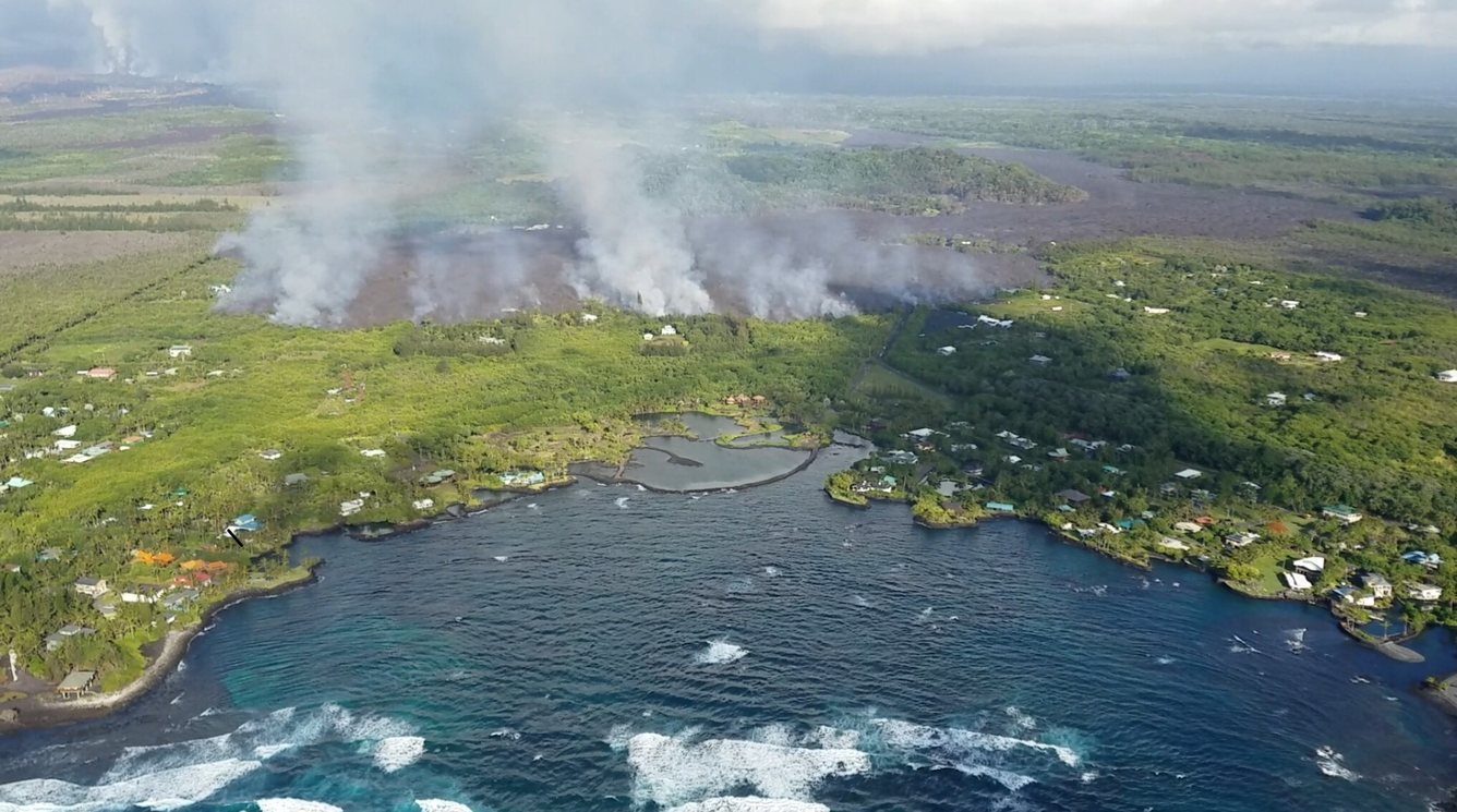
Fissure 8 flow front
Photo from 7AM helicopter overflight, hovering offshore and looking up the flowfront at kapoho. Nearly all of the front was active and advancing; advance rates were estimated at an average of 250 feet/hour (76 m/hr), and as of 7AM the flow was 500 yards (457 m) from the ocean.
Overflight photo at 7AM HST from offshore looking up the flowfront at Kapoho. Nearly all of the front was active and advancing/spreading.
This thermal image of Kapoho Beach Rd. was taken during a helicopter overflight at approximately 12:30 p.m. HST on June 3, 2018. The temperature scale is estimated using a standard atmospheric temperature correction with blue colors indicative of cooler temperatures and red colors indicative of warmer temperatures. USGS photo.
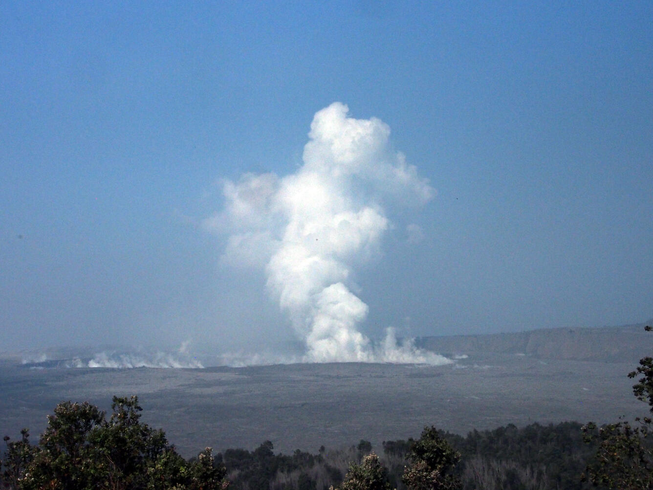
Halema'uma'u Crater and weak plume on morning of June 3
Summit plume at 8:40AM HST on June 3. A slight mist in the air softens the look of the plume, which is predominantly white steam with minor amounts of ash.
Get Our News
These items are in the RSS feed format (Really Simple Syndication) based on categories such as topics, locations, and more. You can install and RSS reader browser extension, software, or use a third-party service to receive immediate news updates depending on the feed that you have added. If you click the feed links below, they may look strange because they are simply XML code. An RSS reader can easily read this code and push out a notification to you when something new is posted to our site.