
Remote Sensing
Remote Sensing
Center of Excellence for Geospatial Information Science (CEGIS)
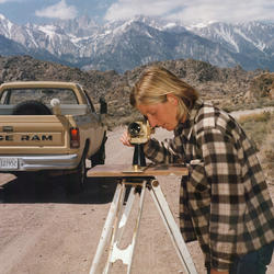
From small cameras to big satellites, remote sensing involves using sensors to measure things from a distance and is an important tool for mapping.
The large extent of the United States makes measuring and mapping the ever-changing surface water a huge challenge.
Remote sensing allows us to understand where and when water is collecting on the earth surface.


Filter Total Items: 3

2026 18th CEGIS Annual Research Meeting
The Center of Excellence for Geospatial Information Science (CEGIS) is proud to host the 2026 18th CEGIS Annual Research Meeting June 23-25, 2026, in Denver, Colorado. The annual research meeting is a special occasion to celebrate our accomplishments, explore ongoing projects, and foster collaboration for future endeavors. This year's gathering featured a broad range of presentations from our...
2025 CEGIS Annual Research Meeting
The Center of Excellence for Geospatial Information Science (CEGIS) was proud to host the 2025 CEGIS Annual Research Meeting July 22-24, 2025. The annual research meeting is a special occasion to celebrate our accomplishments, explore ongoing projects, and foster collaboration for future endeavors. This year's gathering featured a broad range of presentations from our researchers and their...
Remote sensing
From small cameras to big satellites, remote sensing involves using sensors to measure things from a distance and is an important tool for mapping. The large extent of the United States makes measuring and mapping the ever-changing surface water a huge challenge. Remote sensing allows us to understand where and when water is collecting on the earth surface.