
Damage to the brick exterior of the downtown Napa Post Office. Photo take September 11, 2014
Images
Images intro.
Filter Total Items: 56

Damage to the downtown Napa Post Office
Damage to the brick exterior of the downtown Napa Post Office. Photo take September 11, 2014

Collecting topographic data
USGS summer geology interns Alexandra Pickering and Nikita Avdievitch collecting topographic data with a three-dimensional laser scanner on August 26. Surface rupture from the 2014 South Napa Earthquake is visible in the foreground
USGS summer geology interns Alexandra Pickering and Nikita Avdievitch collecting topographic data with a three-dimensional laser scanner on August 26. Surface rupture from the 2014 South Napa Earthquake is visible in the foreground

Surface rupture
Surface rupture in soil near the intersection of state Highway 12 and Cuttings Wharf Road in Napa, CA on August 24, 2104
Surface rupture in soil near the intersection of state Highway 12 and Cuttings Wharf Road in Napa, CA on August 24, 2104

Surface rupture across Los Carneros Ave
Surface rupture across Los Carneros Ave just northwest of South Ave in Napa County, CA. Photo taken by USGS from California Highway Patrol helicopter on August 24, 2014
Surface rupture across Los Carneros Ave just northwest of South Ave in Napa County, CA. Photo taken by USGS from California Highway Patrol helicopter on August 24, 2014

Surface rupture across State Highway 12
Surface rupture across State Highway 12 at Cuttings Wharf Road - Photo taken by USGS from California Highway Patrol helicopter on August 24, 2014
Surface rupture across State Highway 12 at Cuttings Wharf Road - Photo taken by USGS from California Highway Patrol helicopter on August 24, 2014

Collecting topographic data with a three-dimensional laser scanner
Collecting topographic data with a three-dimensional laser scannerUSGS volunteer Whitney DeLong and geology intern Alexandra Pickering collecting topographic data with a three-dimensional laser scanner along Cuttings Wharf Road in Napa County, CA on August 26, 2014. In the background are engineers inspecting the earthquake surface rupture where is passes through a horse paddock.

Rufus Cachings, USGS
Rufus Cachings, USGS standing in front of the globe at the Earthquake Science Center in Menlo Park.
Rufus Cachings, USGS standing in front of the globe at the Earthquake Science Center in Menlo Park.
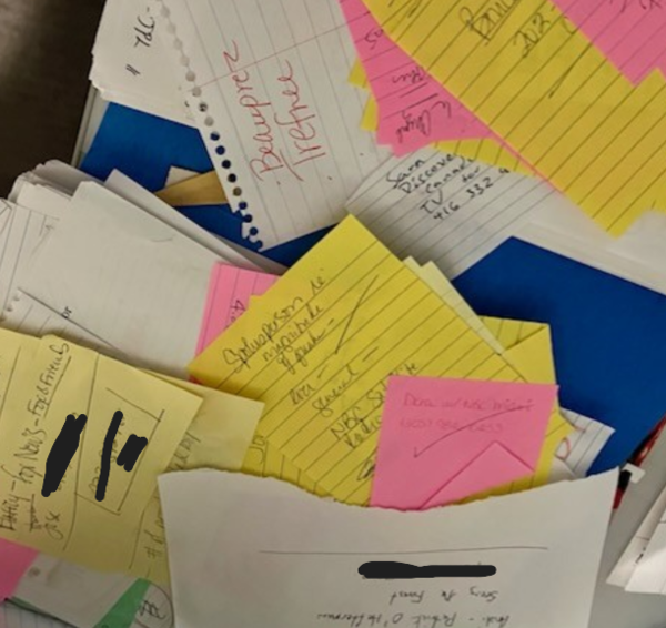
Sticky notes showing media interview requests following the 2004 Sumatra earthquake event.
Sticky notes showing media interview requests following the 2004 Sumatra earthquake event.Sticky notes showing media interview requests by journalists following the 2004 Sumatra earthquake event.
Sticky notes showing media interview requests following the 2004 Sumatra earthquake event.
Sticky notes showing media interview requests following the 2004 Sumatra earthquake event.Sticky notes showing media interview requests by journalists following the 2004 Sumatra earthquake event.
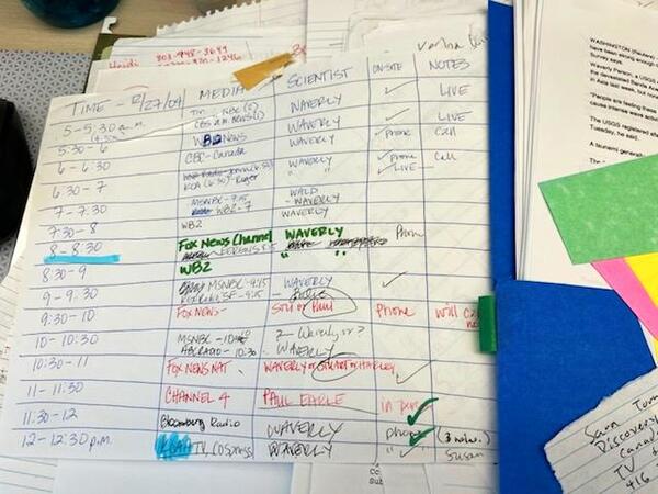
News media interview schedule following Sumatra 2004 earthquake event
News media interview schedule following Sumatra 2004 earthquake eventPhoto showing an intense news media interview schedule following Sumatra 2004 earthquake event.
News media interview schedule following Sumatra 2004 earthquake event
News media interview schedule following Sumatra 2004 earthquake eventPhoto showing an intense news media interview schedule following Sumatra 2004 earthquake event.
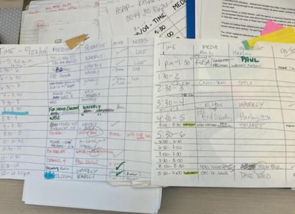
Schedule for news media interviews following Sumatra 2004 earthquake event
Schedule for news media interviews following Sumatra 2004 earthquake eventImage of schedule for news media interviews following Sumatra 2004 earthquake event.
Schedule for news media interviews following Sumatra 2004 earthquake event
Schedule for news media interviews following Sumatra 2004 earthquake eventImage of schedule for news media interviews following Sumatra 2004 earthquake event.

Landers rupture
Surface rupture from the Landers earthquake. The fault movement in the earthquake was mostly sideways; i.e., the two sides of the faults movement horizontally relative to one-another. The fault scarp at the surface was most dramatic in places where the two sides of the fault moved both vertically and horizontally relative to one-another.
Surface rupture from the Landers earthquake. The fault movement in the earthquake was mostly sideways; i.e., the two sides of the faults movement horizontally relative to one-another. The fault scarp at the surface was most dramatic in places where the two sides of the fault moved both vertically and horizontally relative to one-another.

Landers Rupture
Earthquake rupture along HWY 247 (Old Woman Springs Rd), north of Yucca Valley about 4 or 5 miles.
Earthquake rupture along HWY 247 (Old Woman Springs Rd), north of Yucca Valley about 4 or 5 miles.

Landers Rupture
Earthquake rupture along HWY 247 (Old Woman Springs Rd), north of Yucca Valley about 4 or 5 miles.
Earthquake rupture along HWY 247 (Old Woman Springs Rd), north of Yucca Valley about 4 or 5 miles.

Landers Rupture
Earthquake rupture along HWY 247 (Old Woman Springs Rd), north of Yucca Valley about 4 or 5 miles.
Earthquake rupture along HWY 247 (Old Woman Springs Rd), north of Yucca Valley about 4 or 5 miles.