
Mapping riverine habitats of the Delaware River using bathymetric LiDAR
Ecosystem management and assessment of rivers requires detailed data on bathymetry before estimates of aquatic habitats can be determined. However, mapping bathymetry in shallow rivers is challenging due to river depth limitations for watercraft.
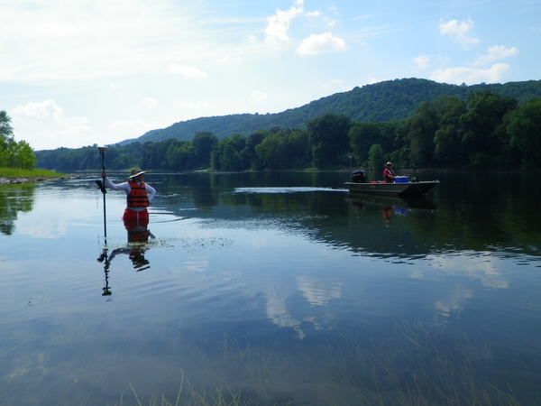
Objectives of this project were to test the capability of an aerial bathymetric LiDAR system (EAARL-B) for mapping a large stretch (196 km, 122 miles) of the Delaware River (USA). We acquired, processed are evaluating this data through comparison with boat-based dual-beam sonar depth mapping and wading elevation surveys using RTK-GPS at 14 river access locations throughout the mapped area. While quantifying differences with boat-based sonar depth mapping is problematic, the bathymetric lidar derived elevations compare well with RTK GPS elevations (RMSE 0.244m overall), although differences in mapping accuracy by bottom substrate are evident.

Ecosystem management and assessment of rivers requires detailed data on bathymetry before estimates of aquatic habitats can be determined. However, mapping bathymetry in shallow rivers is challenging due to river depth limitations for watercraft.
Objectives of this project were to test the capability of an aerial bathymetric LiDAR system (EAARL-B) for mapping a large stretch (196 km, 122 miles) of the Delaware River (USA). We acquired, processed are evaluating this data through comparison with boat-based dual-beam sonar depth mapping and wading elevation surveys using RTK-GPS at 14 river access locations throughout the mapped area. While quantifying differences with boat-based sonar depth mapping is problematic, the bathymetric lidar derived elevations compare well with RTK GPS elevations (RMSE 0.244m overall), although differences in mapping accuracy by bottom substrate are evident.