



Recent improvements to the Burn Severity Portal have streamlined data access for wildfire response and analysis.
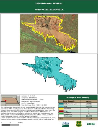
The 2026 third quarter release for the Burn Severity Portal includes 315 fires from multiple fire seasons for Monitoring Trends in Burn Severity (MTBS), 25 fires from multiple seasons for the Burned Area Emergency Response (BAER) project, and 67 fire mapping data sets for the Rapid Assessment of Vegetation Cover After Wildfire (RAVG) project. MTBS has mapped large fires across the United States from 1984 to present, growing to an archive of nearly 31,000 fires.
In addition to these new fires, previously released map products that had been temporarily removed for reprocessing have also been re-issued. This reissue includes 221 fire maps for MTBS, five fire maps for BAER, 30 fire datasets for the National Park Service (NPS) project, two fires from 2026 for the Provisional Initial Assessment (PIA) project, and 43 fire mapping datasets for RAVG.
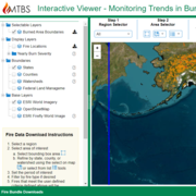
Direct Download data access has been extended for users. Requests can be made for fire occurrence and polygon products for Composite Burn Index, U.S. Fish & Wildlife Service (FWS), NPS, PIA, Prairie Fires, and Undersized Fire Mapping Project (UFPM). Raster mosaics by extent and year are available for NPS, PIA and UFPM products, in addition to MTBS and RAVG. Fire occurrence and polygon products are also available for NPS, PIA, UFPM, MTBS and RAVG programs.
Plans are underway to expand access to BAER products.
MTBS aims to consistently map the extent and severity of large fires across all U.S. lands from 1984 to the present and to make those data readily accessible.
Have you used MTBS products? We welcome your feedback on the MTBS Customer Satisfaction and Needs Assessment form.
Related
Learn more about Wildfire Burn Severity Mapping.

Wildfire Burn Severity Mapping (AD)
Have you ever wondered how scientists determine the burn severity of wildfire? Researchers use satellites to scan Earth and identify where plants and trees have been burned. The scans are used to compare the reflectiveness of green plants to other charred or blackened surfaces. And create maps that show unburned and high, medium, or low-severity burned areas. Burn severity maps are used by...
Hundreds of Fire Maps Released on Burn Severity Portal Hundreds of Fire Maps Released on Burn Severity Portal
Related
Learn more about Wildfire Burn Severity Mapping.
Wildfire Burn Severity Mapping (AD)
Have you ever wondered how scientists determine the burn severity of wildfire? Researchers use satellites to scan Earth and identify where plants and trees have been burned. The scans are used to compare the reflectiveness of green plants to other charred or blackened surfaces. And create maps that show unburned and high, medium, or low-severity burned areas. Burn severity maps are used by...