
FORT Science in Action, Part 6: Wild horse and burro research to support Interior managers, rural economies, tribal partners, and world-class hunting
In collaboration with universities, federal land management agencies, state wildlife organizations, and tribal biologists, FORT scientists are refining methods to accurately count wild horses and burros, investigating how these equines interact with native ecosystems, and testing what organizations can do to effectively manage wild equine populations.
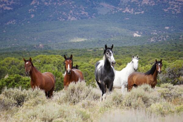
Overabundant wild horses and burros occur across seven western states, on Bureau of Land Management (BLM), US Forest Service (USFS), National Park Service (NPS), and tribal lands, costing taxpayers over \$100M annually. FORT scientists work closely with managers to provide actionable science, such as predictive population modeling, and new tools for monitoring. Here are a few examples:
- The PopEquus application provides information to help understand trade-offs and inform decisions on horse population management. This tool is currently required for BLM managers to use prior to conducting a gather/removal of wild horses and results are used in their environmental assessments– making this tool critical for conducting management actions.
- USGS also developed and tested the first GPS collar applied to BLM horses, which helps BLM understand seasonal distribution and address conflicts with local landowners.
- The Grazing Exploration Tool centralizes grazing records from the last two decades for livestock and wild horse populations across the Western US. Available to BLM partners, this tool summarizes grazing-related records for management areas, displaying how different grazing metrics may interact with vegetation, disturbance, and wildlife patterns.
Through tools like these, USGS provides support for partners in decision-making. BLM uses USGS science in decision-making, including environmental analysis. State agencies use USGS science as they seek to understand how wild horses may impact hunting. Tribes use USGS science to figure out how many horses they have and how horses impact tribal lands and native wildlife. Additionally, the National Wild Horse and Burro Advisory Board uses USGS science to make recommendations to BLM management.
More FORT Science in Action
This September, FORT is highlighting how our science projects support sound decision-making. Each day, we will highlight a new project and its applications. To see more, follow the tabs below.
FORT Science in Action, Part 5
FORT Science in Action, Part 7
Related

Counting America’s Wild Horses and Burros: Better Estimates for Population Management

Wild horse and livestock influences on vegetation and wildlife in sagebrush ecosystems: Implications for refining and validating Appropriate Management Level (AML)
Related
Counting America’s Wild Horses and Burros: Better Estimates for Population Management