Hood River at Tucker Bridge, near Hood River Oregon
Hood River at Tucker Bridge, near Hood River OregonRising waters near the USGS streamflow gage along Hood River.

Official websites use .gov
A .gov website belongs to an official government organization in the United States.
Secure .gov websites use HTTPS
A lock () or https:// means you’ve safely connected to the .gov website. Share sensitive information only on official, secure websites.
USGS response to Oregon high flows, December 2025.
In response to the atmospheric river moving through the region this week, hydrologic technicians across Oregon measured high-flows and made sure streamflow gages were functioning. These efforts are critical for accurate streamflow monitoring and flood response.

During floods, USGS conducts streamflow measurements to define the relationship between river stage and flow rate.
Why this matters: High flows are rare, so every measurement improves accuracy for future flood predictions.
These measurements refine stage-discharge (flow) rating curves, which are essential for calculating flow at gages year-round.
Streamflow data is publicly available at Water Data for the Nation.
High flow field work photos:
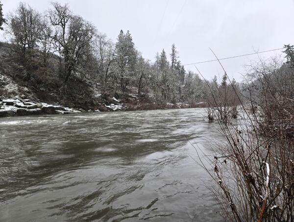
Rising waters near the USGS streamflow gage along Hood River.
Rising waters near the USGS streamflow gage along Hood River.
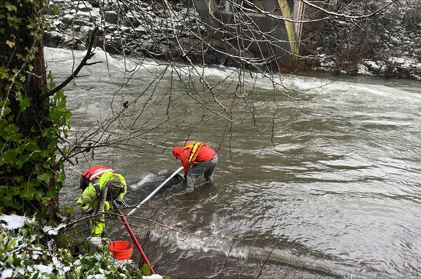
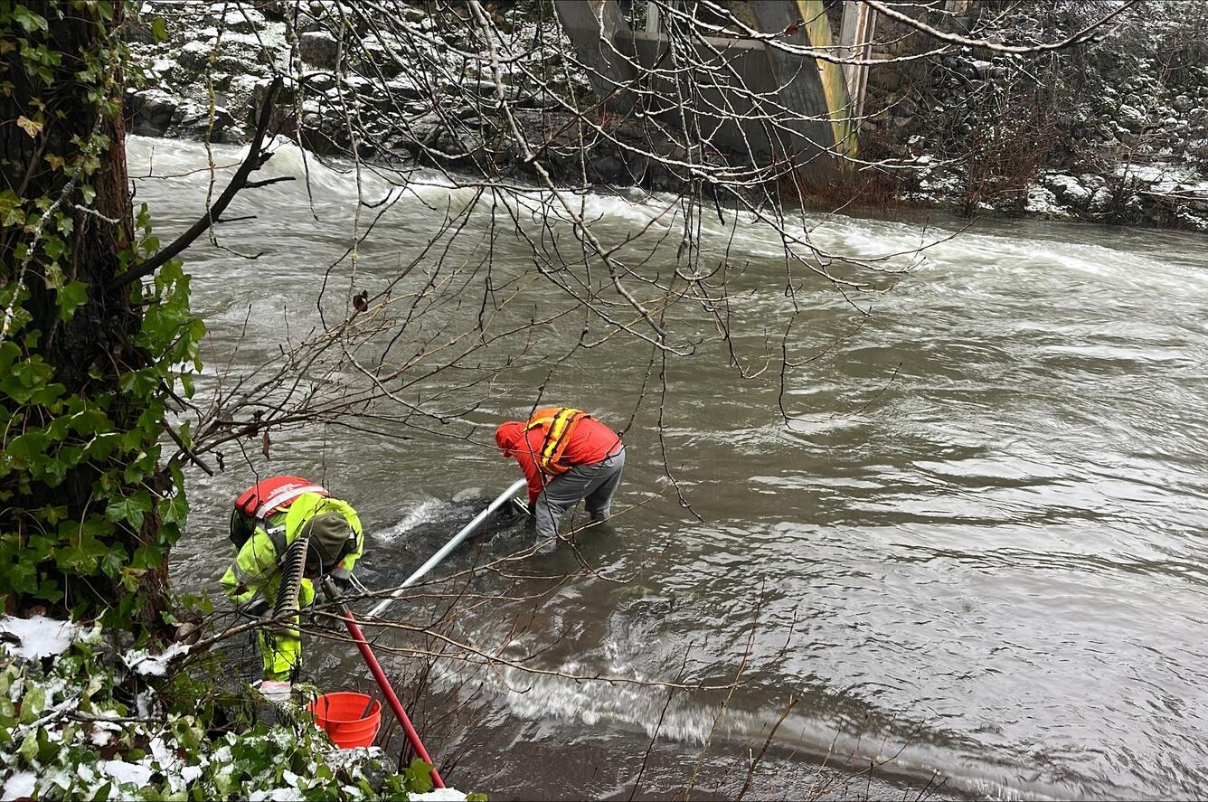
Hydrologic technicians installing temporary orifice line in the stream to restore stage readings during a rising flood.
Hydrologic technicians installing temporary orifice line in the stream to restore stage readings during a rising flood.
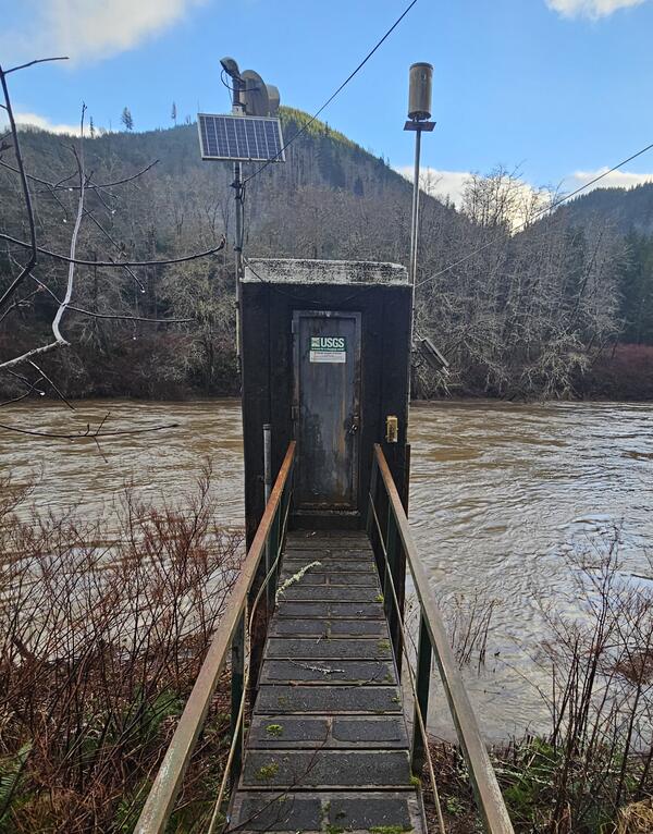
The concrete gage house on the Nehalem River near Foss, OR. This site (# 14301000) is a USGS Federal Priority streamgage.
The concrete gage house on the Nehalem River near Foss, OR. This site (# 14301000) is a USGS Federal Priority streamgage.
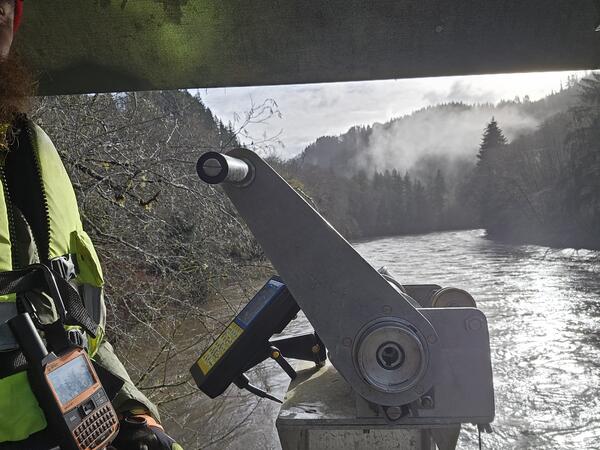
A skilled hydrologic technician measures high flows from a cable car over the Nehalem River near Foss, OR.
A skilled hydrologic technician measures high flows from a cable car over the Nehalem River near Foss, OR.
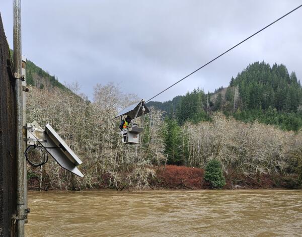
A highly skilled hydrologic technician measures high flows from a cable way over the Nehalem River near Foss, OR.
A highly skilled hydrologic technician measures high flows from a cable way over the Nehalem River near Foss, OR.
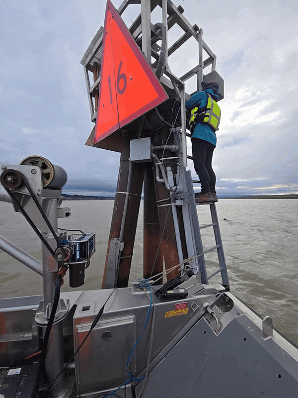
A highly skilled hydrologic technician maintains monitoring equipment in the Columbia River at Vancouver, WA. They are climbing a structure called a "dolphin". In maritime terms, a dolphin is a cluster of pilings driven into the riverbed, often used for mooring or as a base for a light or sign. This dolphin also secures USGS equipment critical for flow monitoring.
A highly skilled hydrologic technician maintains monitoring equipment in the Columbia River at Vancouver, WA. They are climbing a structure called a "dolphin". In maritime terms, a dolphin is a cluster of pilings driven into the riverbed, often used for mooring or as a base for a light or sign. This dolphin also secures USGS equipment critical for flow monitoring.
This high flow measurement on the Deschutes River near Culver, OR was the highest measurement since 2017. This site (# 14076500) is operated in cooperation with Portland General Electric.
This high flow measurement on the Deschutes River near Culver, OR was the highest measurement since 2017. This site (# 14076500) is operated in cooperation with Portland General Electric.
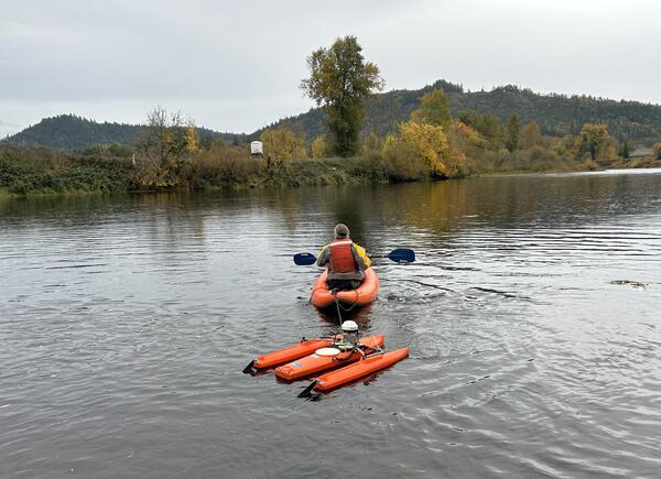
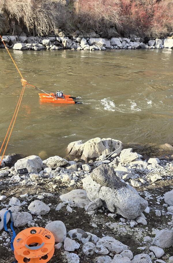
A highly skilled hydrologic technician takes a flow measurement by kayaking an Acoustic Doppler Current Profilier (ADCP) across the channel. The ADCP uses sound waves to measure water speed and depth, to calculate flow volumes.
A highly skilled hydrologic technician takes a flow measurement by kayaking an Acoustic Doppler Current Profilier (ADCP) across the channel. The ADCP uses sound waves to measure water speed and depth, to calculate flow volumes.
High flow field work photos:
Rising waters near the USGS streamflow gage along Hood River.
Rising waters near the USGS streamflow gage along Hood River.
Hydrologic technicians installing temporary orifice line in the stream to restore stage readings during a rising flood.
Hydrologic technicians installing temporary orifice line in the stream to restore stage readings during a rising flood.
The concrete gage house on the Nehalem River near Foss, OR. This site (# 14301000) is a USGS Federal Priority streamgage.
The concrete gage house on the Nehalem River near Foss, OR. This site (# 14301000) is a USGS Federal Priority streamgage.
A skilled hydrologic technician measures high flows from a cable car over the Nehalem River near Foss, OR.
A skilled hydrologic technician measures high flows from a cable car over the Nehalem River near Foss, OR.
A highly skilled hydrologic technician measures high flows from a cable way over the Nehalem River near Foss, OR.
A highly skilled hydrologic technician measures high flows from a cable way over the Nehalem River near Foss, OR.
A highly skilled hydrologic technician maintains monitoring equipment in the Columbia River at Vancouver, WA. They are climbing a structure called a "dolphin". In maritime terms, a dolphin is a cluster of pilings driven into the riverbed, often used for mooring or as a base for a light or sign. This dolphin also secures USGS equipment critical for flow monitoring.
A highly skilled hydrologic technician maintains monitoring equipment in the Columbia River at Vancouver, WA. They are climbing a structure called a "dolphin". In maritime terms, a dolphin is a cluster of pilings driven into the riverbed, often used for mooring or as a base for a light or sign. This dolphin also secures USGS equipment critical for flow monitoring.
This high flow measurement on the Deschutes River near Culver, OR was the highest measurement since 2017. This site (# 14076500) is operated in cooperation with Portland General Electric.
This high flow measurement on the Deschutes River near Culver, OR was the highest measurement since 2017. This site (# 14076500) is operated in cooperation with Portland General Electric.
A highly skilled hydrologic technician takes a flow measurement by kayaking an Acoustic Doppler Current Profilier (ADCP) across the channel. The ADCP uses sound waves to measure water speed and depth, to calculate flow volumes.
A highly skilled hydrologic technician takes a flow measurement by kayaking an Acoustic Doppler Current Profilier (ADCP) across the channel. The ADCP uses sound waves to measure water speed and depth, to calculate flow volumes.