
“Flying Eyeball” Measures Grand Canyon Sand
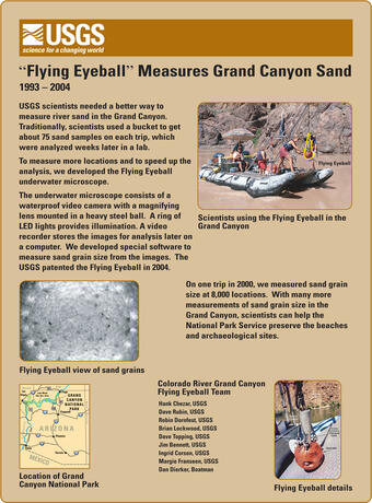
Information about the USGS Pacific Coastal and Marine Science Center's development of an instrument called the "flying eyeball" to measure river sand, from 1993-2004.
USGS Sound Waves newsletter article:
“Sedimentologic Engineering in Grand Canyon”
Publications by USGS collaborators:
Buscombe, D., 2008, Estimation of grain size distributions and associated parameters from digital images of sediment: Sedimentary Geology, v. 210, i. 1-2, p. 1-10, doi: 10.1016/j.sedgeo.2008.06.007
Buscombe, D., and Masselink, G., 2009, Grain size information from the statistical properties of digital images of sediment: Sedimentology, v. 56, i. 2, p. 421-438, doi:10.1111/j.1365-3091.2008.00977.x