
2019 Regional geophysical surveys of northern and central Cascadia (offshore Washington and Oregon)
Geophysical data collected offshore of Washington and Oregon in 2019, a USGS-University of Washington partnership

These surveys are part of the USGS project, “Cascadia Subduction Zone Marine Geohazards.”
Objectives
Systematic characterization of upper plate structure and offshore geohazards in northern Cascadia.
Participants
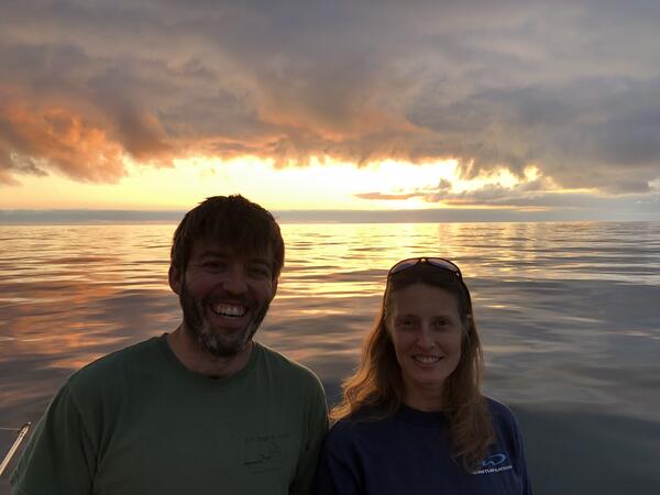
USGS Scientists: Nathan Miller and Janet Watt (Principal Investigators) (Photo 1), Jared Kluesner, Pat Hart, Ray Sliter, Alicia Balster-Gee, Rob Wyland, Alex Nichols, Sam Heller, Rachel Marcuson; UW Scientist Emily Roland (PI); UW students Emma Myers, Anna Boyar, Chris Williams and Kevin Pszczola
Partner
University of Washington
Platform Used
University of Washington’s R/V Rachel Carson (Photo 4)
Data Collected
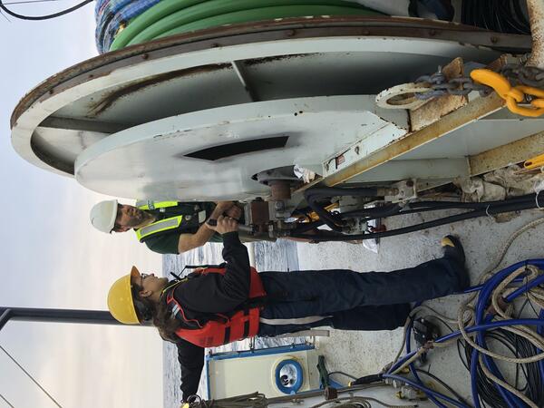
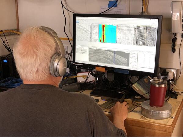
Sparker multi-channel seismic (MCS), Chirp sub-bottom (Photos 2, 3, & 5)
Highlights
- Systematic cross-margin imaging of entire U.S. margin is complete
- Imaging confirms highly variable along-strike structure and morphology of the wedge
~ ~ ~ ~ ~ ~ ~ ~ ~ ~ ~ ~ ~ ~ ~ ~

~ ~ ~ ~ ~ ~ ~ ~ ~ ~ ~ ~ ~ ~ ~ ~

Geophysical data collected offshore of Washington and Oregon in 2019, a USGS-University of Washington partnership
These surveys are part of the USGS project, “Cascadia Subduction Zone Marine Geohazards.”
Objectives
Systematic characterization of upper plate structure and offshore geohazards in northern Cascadia.
Participants
USGS Scientists: Nathan Miller and Janet Watt (Principal Investigators) (Photo 1), Jared Kluesner, Pat Hart, Ray Sliter, Alicia Balster-Gee, Rob Wyland, Alex Nichols, Sam Heller, Rachel Marcuson; UW Scientist Emily Roland (PI); UW students Emma Myers, Anna Boyar, Chris Williams and Kevin Pszczola
Partner
University of Washington
Platform Used
University of Washington’s R/V Rachel Carson (Photo 4)
Data Collected
Sparker multi-channel seismic (MCS), Chirp sub-bottom (Photos 2, 3, & 5)
Highlights
- Systematic cross-margin imaging of entire U.S. margin is complete
- Imaging confirms highly variable along-strike structure and morphology of the wedge
~ ~ ~ ~ ~ ~ ~ ~ ~ ~ ~ ~ ~ ~ ~ ~
~ ~ ~ ~ ~ ~ ~ ~ ~ ~ ~ ~ ~ ~ ~ ~