
USGS attends the ESRI Federal Geographic Information Systems 2026 Conference
By Upper Midwest Water Science Center
February 16, 2026
Members of the Web Informatics and Mapping (WIM) team represented the USGS at a booth at the ESRI Federal Geographic Information Systems (GIS) Conference in Washington, DC.
WIM Geographers Milan Liu and Lauren Privette engaged with representatives from numerous federal agencies, sharing updates on key USGS initiatives including the National Geospatial Program, The National Map, the 3D Elevation Program, the 3D Hydrography Program, and the Landsat Program.
Based out of the Upper Midwest Water Science Center, WIM is a team of Geographers, Hydrologists, Physical Scientists, Computer Scientists, and IT Specialists who develop web-based tools that support USGS science and other federal science initiatives.
Media
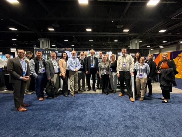
USGS Director Ned Mamula (center) withUSGS attendees at the ESRI Federal Geographic Information Systems (GIS) Conference in February 2026, in Washington, DC.
Sources/Usage: Public Domain. View Media Details
Media
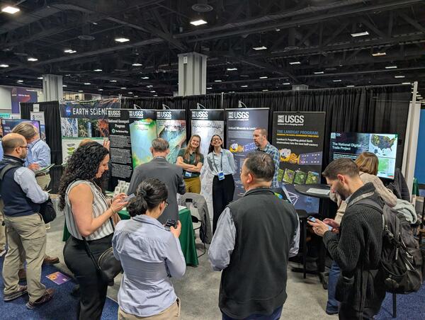
Members of the USGS Web Informatic and Mapping (WIM) team Lauren Privette (left) and Milan Liu (right) host a booth at the ESRI Federal GIS Conference 2026, in Washington, DC.
Sources/Usage: Public Domain. View Media Details