
Improving the understanding of groundwater hydrology near the Yakima Training Center, Washington
The Issue: The Yakima Training Center (YTC) is a military training installation located in south-central Washington. Recent sampling of groundwater wells on and off the base has detected per- and polyfluoroalkyl substances (PFAS)—man-made chemicals that, in some areas, exceed State or Federal drinking-water standards.
The local geology is highly complex, featuring folded and faulted bedrock. Currently, the way groundwater moves through these layers is not fully understood, making it difficult to predict how contaminants might spread and how remediation efforts are best targeted.
How the U.S. Geological Survey will help: The U.S. Geological Survey (USGS) is conducting a multi-phase study to provide the foundational data needed for the U.S. Army and local water managers to plan effective cleanup and remediation. This research will also help improve our broader understanding of local water supplies and long-term aquifer sustainability.

Phase 1
Hydrogeologic framework near the Yakima Training Center, Washington
Objectives
The objective of this phase is to develop a detailed conceptual understanding of the groundwater-flow system near the Yakima Training Center. Hydrologic and geologic information from existing studies will be synthesized with new information from drillers’ well logs, groundwater-level measurements (hereafter, water-level measurements), and water-quality data collected from wells.
Approach
To meet the objective of this phase, the approach will be split into three primary tasks:
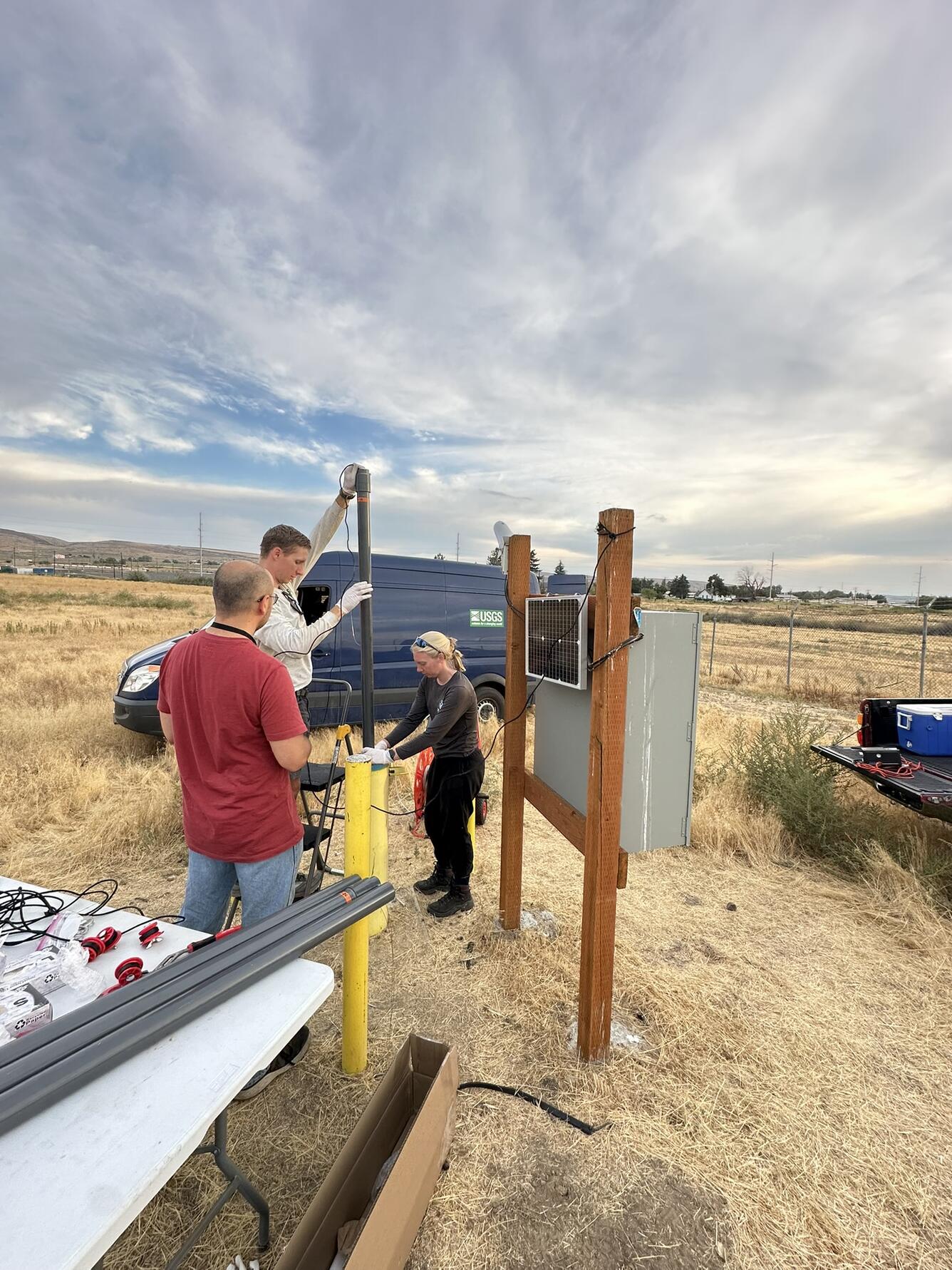
- For Task 1, well logs will be reviewed to develop a well database that includes wells that can be used for groundwater-level measurements and in the development of the hydrogeologic framework. Discrete groundwater levels from about 50–75 selected wells will be measured quarterly for a complete year to capture the seasonal variation in groundwater conditions.
- For Task 2, discrete water-quality samples will be collected from a subset of groundwater wells and used to evaluate groundwater flow paths and the influence of surface-water irrigation. No PFAS data will be collected as part of this phase.
- For Task 3, a 3D hydrogeologic model will be developed that describes the physical, lithologic, and hydrologic characteristics of the hydrogeologic units in the study area.
Deliverables
Data:
- All groundwater-level and water-quality data collected for this phase are available at the USGS National Water Information System (NWIS) database: https://doi.org/10.5066/F7P55KJN.
- In addition, the 3D hydrogeologic model and a compilation of the groundwater-level and water-quality data will be published as a data release at the USGS ScienceBase data repository: https://www.usgs.gov/tools/sciencebase.
Report:
- The methods, results, and interpretations of this phase will be published in a USGS Scientific Investigations Report.
Phase 2
Quantifying PFAS mass flux and Darcy flux at Yakima Training Center, Washington
Objectives
The objective of this phase is to directly quantify PFAS mass flux and groundwater-flow rates (Darcy flux) at YTC using passive flux meters (PFM). This information will help to characterize aquifer characteristics at YTC and better understand PFAS transport mechanisms in the subsurface. This phase will complement prior and ongoing investigations performed by USGS and Army at YTC.
Approach
To meet the objective of this phase, PFMs will be deployed in 12 on-base monitoring wells for two 2–6-week periods. Data-collection periods will occur in September–October 2025 and September–October 2026—near the end of the irrigation season.
PFMs contain a permeable sorbent that will retain dissolved contaminants (PFAS) present in the groundwater that intercepts the unit. In addition, the sorbent is preloaded with resident tracers which are displaced at a rate proportional to the groundwater flux, allowing the groundwater-flow rate to be directly computed. PFMs will be deployed across the screened interval of each well and each 5-ft-long PFM will have 3 vertically separated sample points, which will allow for the evaluation of depth-specific variability in mass flux and flow rates. Depending on the vertical variability observed during the first deployment, the number of sampling points within each PFM may be reduced from 3 to 2 for the second deployment.
Before and after PFM deployments, a subset of wells will be purged and traditional grab samples will be collected. The grab samples will be compared to the results from the PFMs to compare the two methods. The PFMs and grab samples will both be analyzed for the PFAS analytes in EPA Method 1633 at a Department of Defense- and USGS-approved lab.
Deliverables
Data:
- The Darcy flux and PFAS mass flux data will be published as a data release in the USGS ScienceBase data repository: https://www.usgs.gov/tools/sciencebase.
- The results from the PFAS grab samples will be published in the USGS National Water Information System (NWIS) database: https://doi.org/10.5066/F7P55KJN.
Report:
- The methods, results, and interpretations of this phase will be published in a USGS Scientific Investigations Report or equivalent journal.
The Issue: The Yakima Training Center (YTC) is a military training installation located in south-central Washington. Recent sampling of groundwater wells on and off the base has detected per- and polyfluoroalkyl substances (PFAS)—man-made chemicals that, in some areas, exceed State or Federal drinking-water standards.
The local geology is highly complex, featuring folded and faulted bedrock. Currently, the way groundwater moves through these layers is not fully understood, making it difficult to predict how contaminants might spread and how remediation efforts are best targeted.
How the U.S. Geological Survey will help: The U.S. Geological Survey (USGS) is conducting a multi-phase study to provide the foundational data needed for the U.S. Army and local water managers to plan effective cleanup and remediation. This research will also help improve our broader understanding of local water supplies and long-term aquifer sustainability.
Phase 1
Hydrogeologic framework near the Yakima Training Center, Washington
Objectives
The objective of this phase is to develop a detailed conceptual understanding of the groundwater-flow system near the Yakima Training Center. Hydrologic and geologic information from existing studies will be synthesized with new information from drillers’ well logs, groundwater-level measurements (hereafter, water-level measurements), and water-quality data collected from wells.
Approach
To meet the objective of this phase, the approach will be split into three primary tasks:
- For Task 1, well logs will be reviewed to develop a well database that includes wells that can be used for groundwater-level measurements and in the development of the hydrogeologic framework. Discrete groundwater levels from about 50–75 selected wells will be measured quarterly for a complete year to capture the seasonal variation in groundwater conditions.
- For Task 2, discrete water-quality samples will be collected from a subset of groundwater wells and used to evaluate groundwater flow paths and the influence of surface-water irrigation. No PFAS data will be collected as part of this phase.
- For Task 3, a 3D hydrogeologic model will be developed that describes the physical, lithologic, and hydrologic characteristics of the hydrogeologic units in the study area.
Deliverables
Data:
- All groundwater-level and water-quality data collected for this phase are available at the USGS National Water Information System (NWIS) database: https://doi.org/10.5066/F7P55KJN.
- In addition, the 3D hydrogeologic model and a compilation of the groundwater-level and water-quality data will be published as a data release at the USGS ScienceBase data repository: https://www.usgs.gov/tools/sciencebase.
Report:
- The methods, results, and interpretations of this phase will be published in a USGS Scientific Investigations Report.
Phase 2
Quantifying PFAS mass flux and Darcy flux at Yakima Training Center, Washington
Objectives
The objective of this phase is to directly quantify PFAS mass flux and groundwater-flow rates (Darcy flux) at YTC using passive flux meters (PFM). This information will help to characterize aquifer characteristics at YTC and better understand PFAS transport mechanisms in the subsurface. This phase will complement prior and ongoing investigations performed by USGS and Army at YTC.
Approach
To meet the objective of this phase, PFMs will be deployed in 12 on-base monitoring wells for two 2–6-week periods. Data-collection periods will occur in September–October 2025 and September–October 2026—near the end of the irrigation season.
PFMs contain a permeable sorbent that will retain dissolved contaminants (PFAS) present in the groundwater that intercepts the unit. In addition, the sorbent is preloaded with resident tracers which are displaced at a rate proportional to the groundwater flux, allowing the groundwater-flow rate to be directly computed. PFMs will be deployed across the screened interval of each well and each 5-ft-long PFM will have 3 vertically separated sample points, which will allow for the evaluation of depth-specific variability in mass flux and flow rates. Depending on the vertical variability observed during the first deployment, the number of sampling points within each PFM may be reduced from 3 to 2 for the second deployment.
Before and after PFM deployments, a subset of wells will be purged and traditional grab samples will be collected. The grab samples will be compared to the results from the PFMs to compare the two methods. The PFMs and grab samples will both be analyzed for the PFAS analytes in EPA Method 1633 at a Department of Defense- and USGS-approved lab.
Deliverables
Data:
- The Darcy flux and PFAS mass flux data will be published as a data release in the USGS ScienceBase data repository: https://www.usgs.gov/tools/sciencebase.
- The results from the PFAS grab samples will be published in the USGS National Water Information System (NWIS) database: https://doi.org/10.5066/F7P55KJN.
Report:
- The methods, results, and interpretations of this phase will be published in a USGS Scientific Investigations Report or equivalent journal.