Oil drilling platform offshore of Huntington Beach, California
Oil drilling platform offshore of Huntington Beach, CaliforniaImage of an oil drilling platform offshore of Huntington Beach, California, with the sun setting behind it.

Official websites use .gov
A .gov website belongs to an official government organization in the United States.
Secure .gov websites use HTTPS
A lock () or https:// means you’ve safely connected to the .gov website. Share sensitive information only on official, secure websites.
“Technically recoverable” means that the oil and/or gas can be produced using currently available technology and industry practices. This is regardless of any economic or accessibility considerations.
For example, the technology required to produce oil from a location might exist, but it costs more than the oil is worth. The oil is still technically recoverable.
Learn more: USGS Energy Assessments

Probably not. In 2000, the USGS assessed undiscovered, technically recoverable oil and gas resources in Saudi Arabia at 87 billion barrels ( USGS 2000 World Petroleum Assessment) compared to a mean estimate of 4.3 billion barrels of undiscovered, technically recoverable continuous oil in the Bakken and Three Forks formations ( USGS 2021 Bakken and Three Forks Assessment). In addition, Saudi Arabia...

USGS oil and gas assessments are for technically recoverable resources, meaning they can be produced using today’s technology and standard industry practices. However, our assessments do not look at what infrastructure would be required to produce these resources, nor does it look at whether it would be profitable to produce them. In addition, USGS assessments are for undiscovered resources, which...

The USGS regularly re-examines our assessments to see if updated information warrants a reassessment. Sometimes more information is available either from USGS research or industry production, and the USGS decides to conduct a new assessment. Learn more: USGS Energy Assessments

This question cannot be answered clearly because the methods used by those organizations to estimate oil and gas resource volumes are often not publicly available to compare step-by-step. One common reason different organizations get different results is based on what the assessments include. USGS estimates are for undiscovered, technically recoverable oil and gas resources. The USGS does not...

Assessments regularly change based on our understanding of geology, as well as advances in technology. As more is learned about the geology of a given formation, both from USGS research and from industry activity, a clearer picture of the potential recoverable oil and gas resources can be created. In some cases, industry activity can show that a rock formation that was previous thought to have...

Image of an oil drilling platform offshore of Huntington Beach, California, with the sun setting behind it.
Image of an oil drilling platform offshore of Huntington Beach, California, with the sun setting behind it.
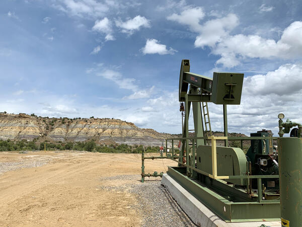
A pumpjack on an active oil or gas drilling site near Farmington, New Mexico. Photo by Mike Duniway, USGS, SBSC.
A pumpjack on an active oil or gas drilling site near Farmington, New Mexico. Photo by Mike Duniway, USGS, SBSC.

Water truck in background is providing maintenance water to a producing well drilled in the Bakken Formation near Williston, North Dakota.
Water truck in background is providing maintenance water to a producing well drilled in the Bakken Formation near Williston, North Dakota.

Water is used for many direct aspects of unconventional oil and gas development including drilling, development, and maintenance of wells. (Photograph by Janet Carter, USGS)
Water is used for many direct aspects of unconventional oil and gas development including drilling, development, and maintenance of wells. (Photograph by Janet Carter, USGS)

A drill rig in the Bakken oil field in Stark County, western North Dakota.
A drill rig in the Bakken oil field in Stark County, western North Dakota.

Active oil and gas pad on Bureau of Land Management lands near Canyonlands National Park, Utah.
Active oil and gas pad on Bureau of Land Management lands near Canyonlands National Park, Utah.
Probably not. In 2000, the USGS assessed undiscovered, technically recoverable oil and gas resources in Saudi Arabia at 87 billion barrels ( USGS 2000 World Petroleum Assessment) compared to a mean estimate of 4.3 billion barrels of undiscovered, technically recoverable continuous oil in the Bakken and Three Forks formations ( USGS 2021 Bakken and Three Forks Assessment). In addition, Saudi Arabia...
USGS oil and gas assessments are for technically recoverable resources, meaning they can be produced using today’s technology and standard industry practices. However, our assessments do not look at what infrastructure would be required to produce these resources, nor does it look at whether it would be profitable to produce them. In addition, USGS assessments are for undiscovered resources, which...
The USGS regularly re-examines our assessments to see if updated information warrants a reassessment. Sometimes more information is available either from USGS research or industry production, and the USGS decides to conduct a new assessment. Learn more: USGS Energy Assessments
This question cannot be answered clearly because the methods used by those organizations to estimate oil and gas resource volumes are often not publicly available to compare step-by-step. One common reason different organizations get different results is based on what the assessments include. USGS estimates are for undiscovered, technically recoverable oil and gas resources. The USGS does not...
Assessments regularly change based on our understanding of geology, as well as advances in technology. As more is learned about the geology of a given formation, both from USGS research and from industry activity, a clearer picture of the potential recoverable oil and gas resources can be created. In some cases, industry activity can show that a rock formation that was previous thought to have...
Image of an oil drilling platform offshore of Huntington Beach, California, with the sun setting behind it.
Image of an oil drilling platform offshore of Huntington Beach, California, with the sun setting behind it.
A pumpjack on an active oil or gas drilling site near Farmington, New Mexico. Photo by Mike Duniway, USGS, SBSC.
A pumpjack on an active oil or gas drilling site near Farmington, New Mexico. Photo by Mike Duniway, USGS, SBSC.
Water truck in background is providing maintenance water to a producing well drilled in the Bakken Formation near Williston, North Dakota.
Water truck in background is providing maintenance water to a producing well drilled in the Bakken Formation near Williston, North Dakota.
Water is used for many direct aspects of unconventional oil and gas development including drilling, development, and maintenance of wells. (Photograph by Janet Carter, USGS)
Water is used for many direct aspects of unconventional oil and gas development including drilling, development, and maintenance of wells. (Photograph by Janet Carter, USGS)
A drill rig in the Bakken oil field in Stark County, western North Dakota.
A drill rig in the Bakken oil field in Stark County, western North Dakota.
Active oil and gas pad on Bureau of Land Management lands near Canyonlands National Park, Utah.
Active oil and gas pad on Bureau of Land Management lands near Canyonlands National Park, Utah.