Oil drilling platform offshore of Huntington Beach, California
Oil drilling platform offshore of Huntington Beach, CaliforniaImage of an oil drilling platform offshore of Huntington Beach, California, with the sun setting behind it.

Official websites use .gov
A .gov website belongs to an official government organization in the United States.
Secure .gov websites use HTTPS
A lock () or https:// means you’ve safely connected to the .gov website. Share sensitive information only on official, secure websites.
Assessments regularly change based on our understanding of geology, as well as advances in technology.
As more is learned about the geology of a given formation, both from USGS research and from industry activity, a clearer picture of the potential recoverable oil and gas resources can be created.
In some cases, industry activity can show that a rock formation that was previous thought to have significant quantities of oil and gas does not. In other cases, advances in research techniques and tools can show a rock formation is more likely to have the conditions necessary to produce oil and gas.
A major source of changes in USGS assessments was the advent of production from continuous resource accumulations, such as shale and other “tight” or impermeable formations.
Learn more: USGS Energy Assessments

Reports of hydraulic fracturing causing felt earthquakes are extremely rare. However, wastewater produced by wells that were hydraulic fractured can cause “induced” earthquakes when it is injected into deep wastewater wells. Wastewater disposal wells operate for longer durations and inject much more fluid than the hydraulic fracturing operations. Wastewater injection can raise pressure levels in...

There isn’t really a “typical” fractured well because the amount of water used depends on the rock formation, the operator, whether the well is vertical or horizontal, and the number of portions (or stages) of the well that are fractured. In addition, some water is recycled from fluids produced by the well, so the net consumption might be smaller at sites that recycle. Water use per well can be...

Image of an oil drilling platform offshore of Huntington Beach, California, with the sun setting behind it.
Image of an oil drilling platform offshore of Huntington Beach, California, with the sun setting behind it.
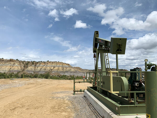
A pumpjack on an active oil or gas drilling site near Farmington, New Mexico. Photo by Mike Duniway, USGS, SBSC.
A pumpjack on an active oil or gas drilling site near Farmington, New Mexico. Photo by Mike Duniway, USGS, SBSC.

This is a graphic from the USGS National Oil and Gas Assessment Explorer application, which allows user to drill into 70 oil and gas assessment provinces throughout the United States.
This is a graphic from the USGS National Oil and Gas Assessment Explorer application, which allows user to drill into 70 oil and gas assessment provinces throughout the United States.

Oil platform in the Gulf of Mexico viewed as part of GoMMAPPS aerial surveys for seabirds.
Oil platform in the Gulf of Mexico viewed as part of GoMMAPPS aerial surveys for seabirds.

Oil well being drilled into the Bakken Formation in North Dakota in 2015.
Oil well being drilled into the Bakken Formation in North Dakota in 2015.

Active oil and gas pad on Bureau of Land Management lands near Canyonlands National Park, Utah.
Active oil and gas pad on Bureau of Land Management lands near Canyonlands National Park, Utah.
Reports of hydraulic fracturing causing felt earthquakes are extremely rare. However, wastewater produced by wells that were hydraulic fractured can cause “induced” earthquakes when it is injected into deep wastewater wells. Wastewater disposal wells operate for longer durations and inject much more fluid than the hydraulic fracturing operations. Wastewater injection can raise pressure levels in...
There isn’t really a “typical” fractured well because the amount of water used depends on the rock formation, the operator, whether the well is vertical or horizontal, and the number of portions (or stages) of the well that are fractured. In addition, some water is recycled from fluids produced by the well, so the net consumption might be smaller at sites that recycle. Water use per well can be...
Image of an oil drilling platform offshore of Huntington Beach, California, with the sun setting behind it.
Image of an oil drilling platform offshore of Huntington Beach, California, with the sun setting behind it.
A pumpjack on an active oil or gas drilling site near Farmington, New Mexico. Photo by Mike Duniway, USGS, SBSC.
A pumpjack on an active oil or gas drilling site near Farmington, New Mexico. Photo by Mike Duniway, USGS, SBSC.
This is a graphic from the USGS National Oil and Gas Assessment Explorer application, which allows user to drill into 70 oil and gas assessment provinces throughout the United States.
This is a graphic from the USGS National Oil and Gas Assessment Explorer application, which allows user to drill into 70 oil and gas assessment provinces throughout the United States.
Oil platform in the Gulf of Mexico viewed as part of GoMMAPPS aerial surveys for seabirds.
Oil platform in the Gulf of Mexico viewed as part of GoMMAPPS aerial surveys for seabirds.
Oil well being drilled into the Bakken Formation in North Dakota in 2015.
Oil well being drilled into the Bakken Formation in North Dakota in 2015.
Active oil and gas pad on Bureau of Land Management lands near Canyonlands National Park, Utah.
Active oil and gas pad on Bureau of Land Management lands near Canyonlands National Park, Utah.