
Fire Danger Forecast
The Fire Danger Project was developed as a joint project involving USGS EROS and collaborators from the USDA Forest Service. This project combines forecast weather data and satellite observations to develop several products depicting the risk for large fire activity across the conterminous United States. Forecast products are produced up to seven days in advance and are updated daily.
WFPI

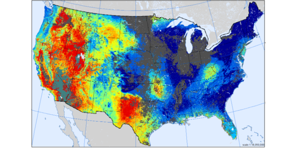
The Wildland Fire Potential Index (WFPI) is sensitive to vegetation flammability based primarily on moisture and wind conditions. It is the base layer that subsequent products are derived from.
WLFP
The WFPI-based Large Fire Probability (WLFP) product represents the probability of a large fire (>500 acres) occurring for a specific time and location. It is based on a statistical model that incorporates WFPI and historical fire activity.
WFSP

The WFPI-based Fire Spread Probability (WFSP) product indicates the statistical probably that an existing one-acre fire will escape initial control efforts and grow to be a large fire (>500 acres). It is based on a historical ignitions data and their relationship to WFPI.

Interactive Viewer
Visualize fire danger products and download areas of interest

Bulk Data
Static Maps
View and download national scale products for specific time periods

Stream Data
Web Services
Access data directly in your GIS or data dashboard utilizing OGC WMS services

Historical Graphs
Regional GACC Plots
View and download regional graphs of current large fire risk in historical context
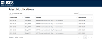
Data Alerts
Missing Products Notifications
View alerts page for missing products