Geology of Mississippi National River and Recreation Area
Learn more about the geology of the Mississippi National River and Recreation Area.
This page will focus on a section of the river through the Mississippi National River and Recreation Area. Although the Mississippi National River and Recreation Area only reaches as far north as Ramsey, Minnesota, our journey will begin 200 miles north at Lake Itasca in Minnesota, at the headwaters of the Mississippi River and travel downstream through the recreation area.

Lake Itasca was formed by glacial activity approximately 14,000 years ago. As the Laurentide Ice Sheet retreated, it shaped the landscape of northern Minnesota and deposited rocks and sediment across the state. As the glacier retreated to the north, it left rock debris and water behind as it melted. The meltwater filled the valleys carved out by the glacier, eventually filling Lake Itasca. Two thousand years later, another lobe of the glacier moved near the lake as it retreated. Although it did not directly pass over Lake Itasca, its meltwater filled other nearby lakes that flow into the Mississippi River, such as Elk Lake. Moving farther down the river, the Mississippi meanders south to the Twin Cities, bringing us to St. Anthony Falls.
St. Anthony Falls & Mill Ruins Park
St. Anthony Falls was not always the landmark of downtown Minneapolis that it is today. In fact, it started out as an entirely different waterfall, over 10 miles east in downtown St. Paul. Approximately 12,000 years ago, the last ice sheet to cover Minnesota retreated and formed Glacial Lake Agassiz. Lake Agassiz stretched out across much of the midwestern United States and even southern Canada, covering portions of Minnesota, North Dakota, Ontario, Saskatchewan, and Manitoba. One of the main outlets of Glacial Lake Agassiz to the south was River Warren, which cut through the Minnesota River Valley. River Warren meandered through southern Minnesota, creating Glacial River Warren Falls near what is now downtown St. Paul, Minnesota.
Glacial River Warren Falls was situated on top of two geologic formations: the Platteville Limestone on top and the St. Peter Sandstone below. As the waterfall flowed, the water slowly eroded the underlying sandstone, causing the overlying limestone to collapse and the falls to retreat upstream toward the west. When the falls reached what would become the junction of the Minnesota and Mississippi Rivers, it split into two parts. One part of the falls moved along the Minnesota River, eventually evolving into rapids and disappearing altogether. The other section migrated upstream on the Mississippi, becoming what is now called St. Anthony Falls.

Fast forward to the 1850s, and Minneapolis is a new city looking for sources of power. In the 1850s and 1860s, companies raced to construct mills along the riverbank and to harness the power of St. Anthony Falls. The same erosion processes that helped Glacial River Warren Falls evolve into St. Anthony Falls made milling risky here. The Platteville Limestone above the eroding sandstone collapsed in 1869, forming a massive whirlpool. Over the course of the next 14 years, the U.S. Army Corps of Engineers constructed an apron, dam, and underground dike to stabilize and protect the falls. Since then, two more dams have been constructed to generate hydroelectric power: the Lower St. Anthony Falls Dam, completed in 1956, and the Upper St. Anthony Falls Dam, completed in 1963. Although the landscape of St. Anthony Falls has drastically changed over its thousands of years of existence, the geologic processes that shaped the land are still at work today.


Mississippi Gorge Regional Park
Moving further downstream, we come across the Mississippi Gorge, a dramatic dip in the landscape. The Mississippi Gorge is the only true gorge along the length of the entire Mississippi River and was created by the same processes that led to the creation of St. Anthony Falls, forming over thousands of years as Glacial River Warren Falls migrated upstream due to erosion along the path of the river.

Minnehaha Falls Regional Park
Minnehaha Falls was formed approximately 5,000 years ago and is migrating upstream in the same way that Glacial Lake Warren Fall moved over time. When it initially formed, it was located where Minnehaha Creek meets the Mississippi River, but thousands of years of erosion from the falls caused it to retreat upstream to its current location. Before the construction of the dam and stabilization of the falls in the 1870s, St. Anthony Falls moved as quickly, as fast as a few feet per year. Much less water passes through Minnehaha Creek than the Mississippi River, so the process of erosion is slower.

Minnehaha Falls is a great place to see the exposed rock formations in the Twin Cities. Behind the falls, the Platteville Limestone formation extends out on top, with the Decorah Shale underlying it and the St. Peter Sandstone at its base.

Brickyards of St. Paul
The Brickyards of St. Paul, an area in Lilydale-Harriet Island Regional Park, is a great place to see the Decorah Shale formation. The Decorah Shale was deposited about 440 million years ago during the Ordovician period, when Minnesota was submerged beneath a shallow sea. The shale was deposited when the sea was deeper than when the Platteville Limestone and St. Peter Sandstone were deposited (450 and 460 million years ago respectively) and contains abundant fossils that are frequently found in deep water. Trilobites and brachiopods are both common and well preserved.


The Brickyards were constructed in 1894 by the Twin Cities Brick Company, which manufactured bricks until its closure in the 1970s. They mined the Decorah Shale in quarries on the bluff, then carried it down to the kilns for brick manufacturing. A brick kiln and a few quarries higher up are easily visible from the path, along with a great deal of exposed, fossil-bearing Decorah Shale. Examples of fossils here include mollusks, brachiopods, bryozoans, and trilobites.
Fountain Cave
Compared to the other places on this list along the river, Fountain Cave may seem more unfamiliar because the entrance to the cave has been closed since 1960. Fountain Cave was formed about 10,000 years ago, when Glacial River Warren Falls migrated downstream past the rocks that would form the cave. As Glacial River Warren Falls eroded the Platteville Limestone to expose the St. Peter Sandstone, it exposed an aquifer that had been capped by limestone. The aquifer was then freed to drain into the Mississippi. As it drained, the water widened the aquifer into a cave.
In the 1880s, the cave was estimated to be about 1,150 feet long. It had a narrow entryway about 15 feet wide that opened up into a great circular room about 50 feet in diameter. It was a popular tourist attraction from 1850 to 1880, until a railroad facility began emptying its sewage and storm water into the cave. The sewage piled up until 1960, when the entrance of the cave was buried by the construction of Shepard Road.
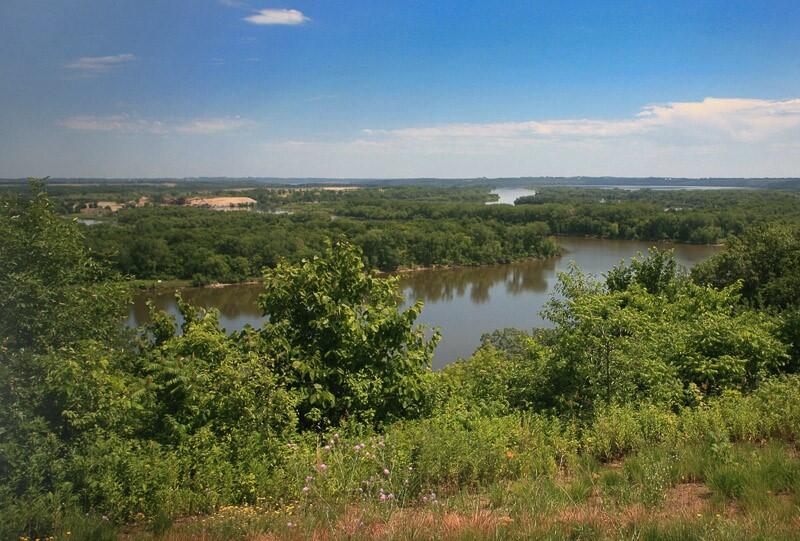
Pine Bend Bluffs and Grey Cloud Dunes Scenic and Natural Area
The Grey Cloud Dunes and Pine Bend Bluffs Scientific and Natural Area’s landscapes were formed over the past 8,000 years by weathering. As Glacial River Warren flowed downstream, the water carved deep into the bedrock, creating the dramatic, 200 feet tall bluffs above the water. Later, during a mid-Holocene dry period 8,000-4,000 years ago, winds blew sand from Grey Cloud Island on top of the bluffs at Grey Cloud Dunes where the dunes remain today.
The National Park Service has a partnership with the USGS through the National Water Quality Program that allows USGS scientists and NPS resource managers to work together on scientific studies and policy. The Mississippi National River and Recreation Area has been the focus of one project comparing biological conditions within the park with those in the Saint Croix National Scenic Riverway.