U.S. flag

An official website of the United States government

Puukohola Heiau National Historic Site 3D Photo Tour


Puukohola Heiau National Historic Site
Volcanic flows from the Hualalai eruption of 1800-1801 reached the ocean and destroyed a Hawaiian village in its path. Additional flows entered the sea along the north Kona coast from eruptions along the Southwest Rift on Mauna Loa in 1859. These flows entered the sea along the coast just south of the Puukohola National Historic Site (Rubin and Doo, 2004; USGS HVO, 1997). Haleakala volcano on Maui rises above the Alenuihaha Channel in the distance.(Credit: Phil Stoffer, USGS. Public domain.)
Puukohola Heiau National Historic Site
Zoomed-in view of lava flows on the northwest side of the Big Island near Puukohola Heiau National Historic Site. Haleakala Volcano on Maui is in the distance.(Credit: Phil Stoffer, USGS. Public domain.)
Puukohola Heiau National Historic Site
View looking south from the Puukohola Heiau National Historic Site parking area toward the Kona Coast and Hualalai volcano. The summit of Hualalai is 8271 feet and is considered the third most active volcano on Hawaii after Mauna Loa and Kilauea.(Credit: Phil Stoffer, USGS. Public domain.)
Puukohola Heiau National Historic Site
Puuhokola Heiau with a traditional Hawaiian offering platform in the foreground.(Credit: Phil Stoffer, USGS. Public domain.)
Puukohola Heiau National Historic Site
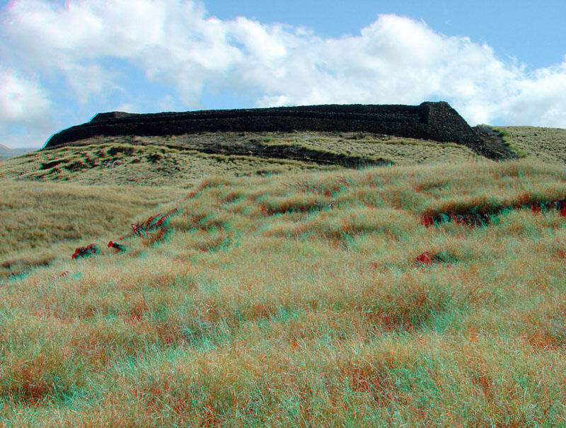
Puukohola Heiau was constructed in 1790-1791 by order of Kamehameha I (or Kamehameha the Great) when his Hawaiian army and subjects invaded and conquered the Big Island and subsequently set up the kingdom of Hawaii, uniting all the islands. The temple was constructed to garner the favor of the Hawaiian war god Kuka'ilimoku. It was used as a site to sacrifice one of the local chiefs whom Kamehameha had come to conquer (NPS, 2002).(Credit: Phil Stoffer, USGS. Public domain.)
Puukohola Heiau National Historic Site
A small bay near Puukohola Heiau is the site of another temple (Hale o Kapuni Heiau) that is now submerged. Sharks are frequently seen feeding in the shallow bay around the submerged temple.(Credit: Phil Stoffer, USGS. Public domain.)
Puukohola Heiau National Historic Site
Puukohola Heiau.(Credit: Phil Stoffer, USGS. Public domain.)
Puukohola Heiau National Historic Site
Puukohola Heiau National Historic Site is on the dry, downwind (Kona) side of the Big Island. This view shows the rocky coast with Hualalai Volcano in the distance.(Credit: Phil Stoffer, USGS. Public domain.)
Puukohola Heiau National Historic Site
Zoomed-in view of the Kona Coast south of Puukohola Heiau National Historic Site. Hualalai Volcano is in the distance.(Credit: Phil Stoffer, USGS. Public domain.)
Puukohola Heiau National Historic Site
A tropical thorn bush, Prosopis, (also called kiawe) was introduced in the early 1800s as a source of food for cattle. The shrub (tree) produces an abundance of pea-like pods. The exotic species has spread throughout the Kona coastal region. Although the plant made good forage for cattle, it now is a hazard in beach areas where thorns can injure tourists. However, it is one of the few shade trees that can survive long drought periods and high salt concentrations on the dry side of the Hawaiian islands (USFS, [2010]).(Credit: Phil Stoffer, USGS. Public domain.)
Puukohola Heiau National Historic Site
Puukohola Heiau with the Kohala Mountains on the north end of the Big Island in the distance.(Credit: Phil Stoffer, USGS. Public domain.)
Puukohola Heiau National Historic Site
View of Mauna Loa volcano from the roadside near Waimea (east of Puukohla Heiau National Historic Site). Mauna Loa is 13,277 feet in elevation and is considered historically the most active volcano on Hawaii.(Credit: Phil Stoffer, USGS. Public domain.)