
New England Lidar-Derived Hydrography Project
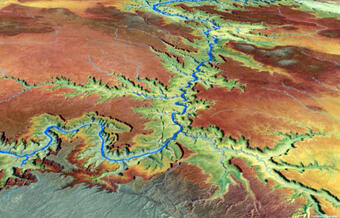
High-quality light detection and ranging (lidar) data from USGS 3D Elevation Program (3DEP) has unlocked the potential to derive new and innovative hydrography datasets such as the USGS next generation 3D Hydrography Program (3DHP) that can be used for many hydrologic and hydraulic (H&H) modeling applications. Federal Emergency Management Agency (FEMA) mapping partners require elevation and hydrography data for H&H modeling input when conducting Base Level Engineering (BLE) for regulatory floodplain hazard mapping. The new 3DHP will provide high-resolution hydrography data that can be leveraged for FEMA BLE to produce model-backed approximate floodplain maps based on the most current topographic data sources.
Objectives:
For more information on USGS 3DHP please visit the following links: