
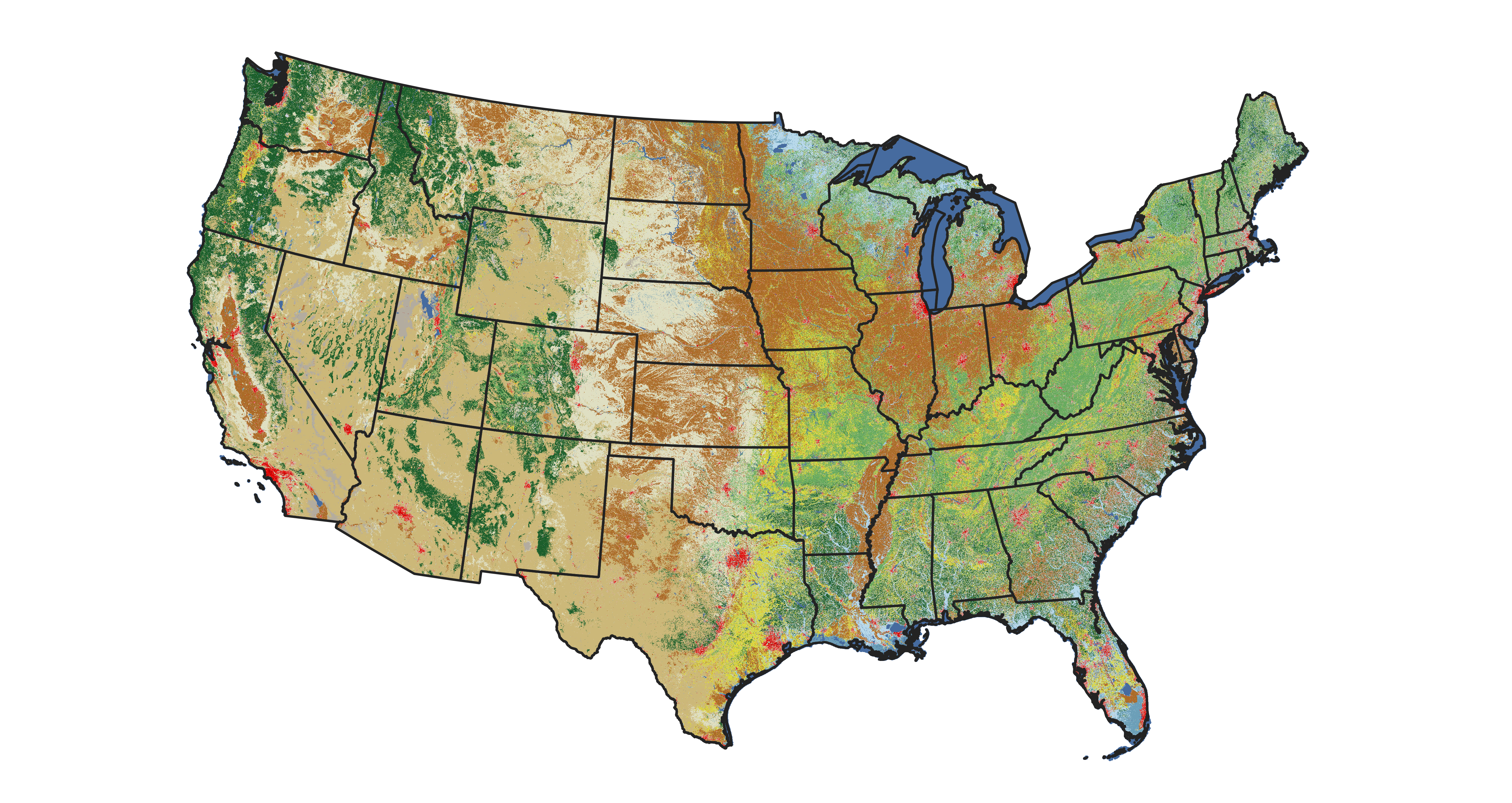
Annual National Land Cover Database (NLCD) land cover map for 2024

Altered Content -
The Annual National Land Cover Database (NLCD) product uses AI in the process of characterizing land cover and land change data.
Detailed Description
Annual National Land Cover Database (NLCD) land cover map for 2024. Annual NLCD has a 40-year historic record of land cover and land change, from 1985-2024. Annual NLCD, based on Landsat data, is produced at the USGS Earth Resources Observation and Science (EROS) Center.
Sources/Usage
Public Domain.