
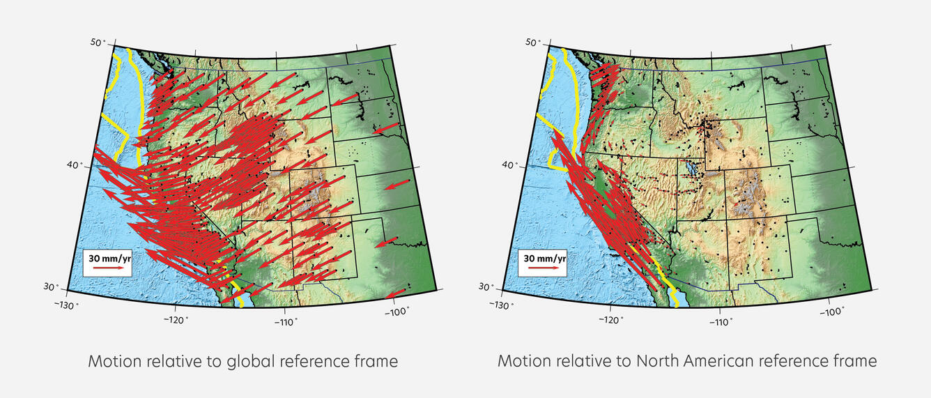
GPS station velocities in the western USA shown in global and North American reference frames
By Yellowstone Volcano Observatory
July 2025 (approx.)
Detailed Description
GPS station velocities in the western USA shown in a global (left) and North American (right) reference frame. The direction and length of each arrow shows where that station is moving over time, and how fast. The global reference frame shows overall motion of the North American plate. The North American reference frame removes the overall plate motion so that areas of stress stand out—in this case, focused along the west coast where stress accumulates along the San Andreas Fault and Cascadia Subduction Zone (plate boundaries are indicated by yellow lines). Figure designed by the EarthScope Consortium.
Sources/Usage
Public Domain.