
July 17, 2025 — Satellite image of Kīlauea tephra and lava flow deposits from ongoing eruption

Detailed Description
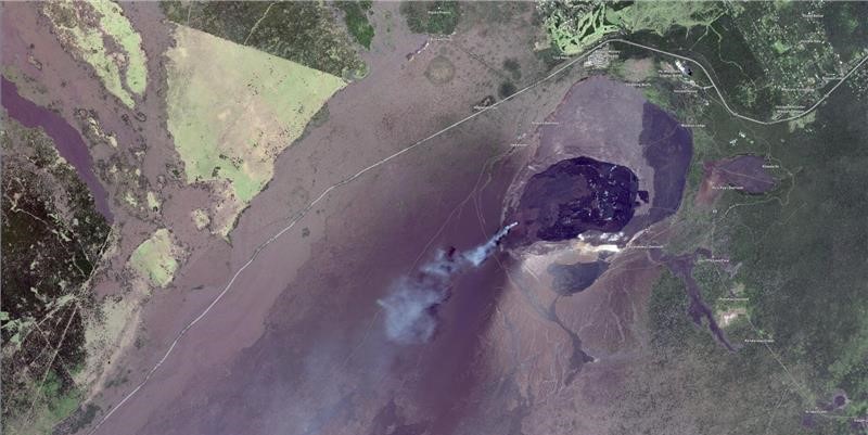
Following episode 28 of lava fountaining at the summit of Kīlauea on July 9, this satellite image was acquired on July 11. It shows the tephra deposit extending in the predominant downwind direction to the southwest in the closed area of Hawaiʻi Volcanoes National Park. Dark-brown to black-colored lava flows emplaced since the eruption began on December 23, 2024, cover the floor of Halemaʻumaʻu crater, an area of 841 acres (340 hectares). Image ©2025 Maxar Technologies, USG Plus.
Sources/Usage
Public Domain.