
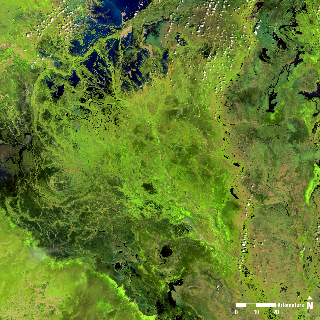
Landsat 8 image of South Sudan
Detailed Description
Landsat 8 image of South Sudan, showing portions of the states of Unity, Jonglei, and Warrup.
Image date: October 22, 2024
Path 174, Row 54
Band combination: 654
The Famine Early Warning Systems Network (FEWS NET) monitors climate and weather conditions around the world and provides early warning information and analysis about food insecurity. Early warning systems can help communities prepare for events and take measures to minimize the potential impacts of disasters.
Scientists at the USGS EROS Center and NASA Goddard Space Flight Center contribute to FEWS NETS modeling, analyses, and monitoring tools. FEWS NET scientists have recently developed a novel approach to forecast floods several months in advance. Flood forecasting is a way to proactively assess flood-related disasters, especially in food-insecure places where flooding can have devastating effects on cropland, food supplies, and livelihoods.
In May 2024, FEWS NET models predicted severe flooding in South Sudan from June through November. Unfortunately, flooding has become a stark reality in South Sudan, one of the most food insecure countries in the world. In October, flooding had impacted an estimated 1.3 million people and 75,000 hectares of cropland. FEWS NET scientists are continuing to monitor the situation and enhance flood prediction models to improve timeliness and save livelihoods.
Sources/Usage
Public Domain.