
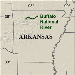
Location map.
By Geosciences and Environmental Change Science Center
2017 (approx.)

Detailed Description
Location of Buffalo National River
Sources/Usage
Public Domain.
Related

Geologic Mapping Studies at Buffalo National River, Northern Arkansas
Detailed geologic mapping is being conducted by the USGS in and adjacent to the Buffalo National River, a park administered by the National Park Service, to better understand and characterize the natural resources and associated ecosystems of this area within the Ozark Plateau region. General-purpose geologic maps are created to provide a framework for a host of natural resource, natural history...
Related
Geologic Mapping Studies at Buffalo National River, Northern Arkansas
Detailed geologic mapping is being conducted by the USGS in and adjacent to the Buffalo National River, a park administered by the National Park Service, to better understand and characterize the natural resources and associated ecosystems of this area within the Ozark Plateau region. General-purpose geologic maps are created to provide a framework for a host of natural resource, natural history...