
Photo & Video Chronology — August 12, 2025 — Mauna Loa monitoring network maintenance
By Hawaiian Volcano Observatory
August 13, 2025
On August 12, USGS-Hawaiian Volcano Observatory field engineers visited monitoring sites on Mauna Loa volcano to upgrade and install new monitoring webcams, change batteries, install new antennas, and replace solar panels that had been damaged during winter storms.
Media
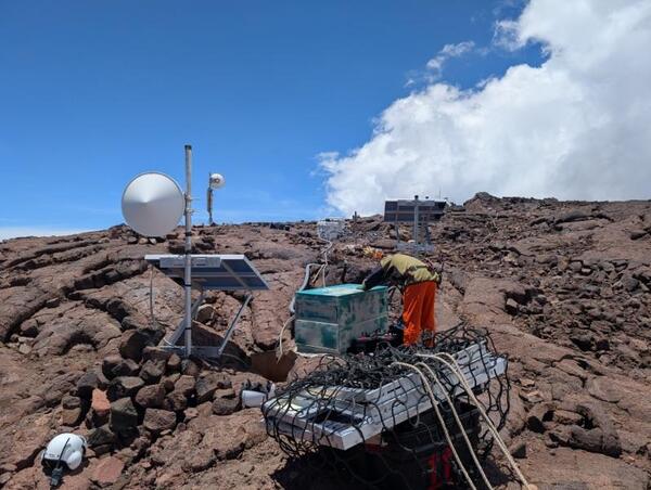
A USGS Hawaiian Volcano Observatory field engineer works on the infrastructure that supports the MLcam and MTcam on the north rim of Moku‘āweoweo, the summit caldera of Mauna Loa volcano. The MLcam provides visual imagery of Moku‘āweoweo while the MTcam provides thermal imagery. The infrastructure at this monitoring site is also an important data transmission hub for other monitoring stations around Mauna Loa. USGS photo by M. Cappos.
Sources/Usage: Public Domain. View Media Details
Media
On August 12, USGS-Hawaiian Volcano Observatory scientists visited the ML/MTcam monitoring site on the north side of Moku‘āweoweo—the summit caldera of Mauna Loa volcano. At the site, field engineers changed batteries, installed a new antenna, and replaced solar panels that had been damaged during winter storms. USGS photo by M. Cappos.
Sources/Usage: Public Domain. View Media Details
Media
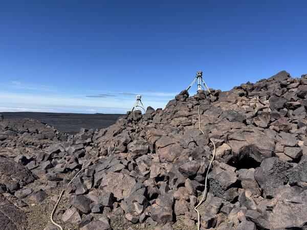
The SPcam (wide angle visual webcam) and MSTcam (thermal camera) are situated next to one another in the summit region of Mauna Loa. Both cameras look south to monitor the uppermost Southwest Rift Zone of Mauna Loa. USGS photo by M. Patrick.
Sources/Usage: Public Domain. View Media Details
Media
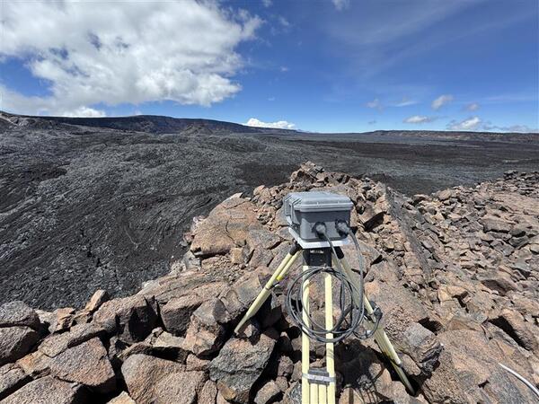
The MOcam webcam is situated in the south end of Mokuʻāweoweo, Mauna Loa's summit caldera, and it looks north to monitor the southern portion of the caldera floor. Nearby, the SPcam is pointed south to monitor the uppermost Southwest Rift Zone of Mauna Loa. USGS photo by M. Patrick.
Sources/Usage: Public Domain. View Media Details
Media
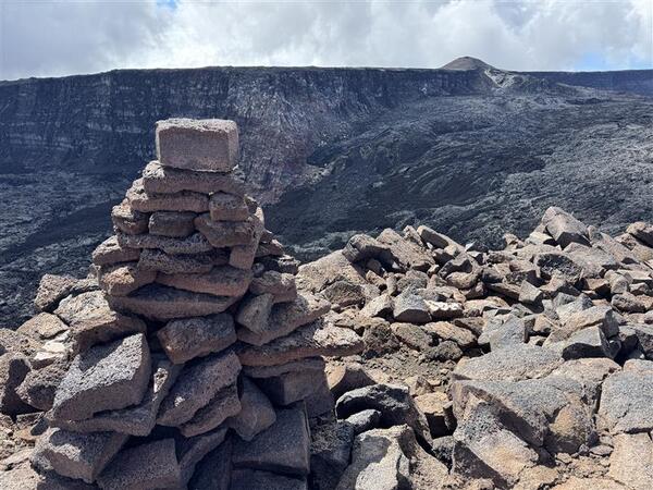
An ahu (cairn) marks the south end of Mokuʻāweoweo, the caldera at the summit of Mauna Loa. This photo shows the cone that formed during the Mauna Loa summit eruption in 1949, in the upper right. Most eruptions of Mauna Loa over the past several hundred years have started within the summit region, and about half have migrated into one of Mauna Loa's two rift zones from there. USGS photo by Matt Patrick.
Sources/Usage: Public Domain. View Media Details
Media
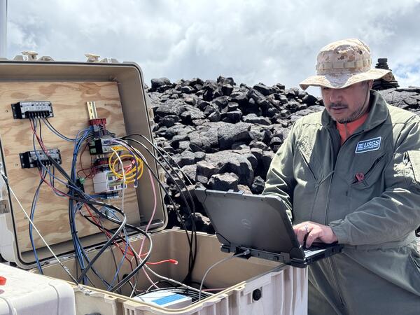
A USGS Hawaiian Volcano Observatory field engineer updates the infrastructure at a remote station in the summit region of Mauna Loa. At this location, two webcams (MOcam and SPcam) were upgraded and a new thermal webcam, the MSTcam, was installed on Mauna Loa summit. USGS photo by M. Patrick.
Sources/Usage: Public Domain. View Media Details
Media
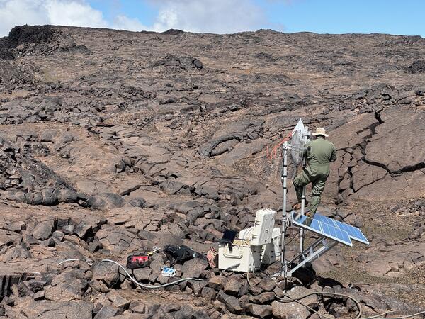
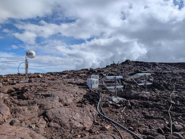
The telemetry network was upgraded yesterday, August 12, 2025, on Mauna Loa to accommodate new webcams around the summit and upper Southwest Rift Zone. Here, an HVO field engineer installs a new antenna that will allow for more efficient transfer of volcano monitoring datasets from remote stations back to the USGS Hawaiian Volcano Observatory. USGS photo by M. Patrick.
Sources/Usage: Public Domain. View Media Details
Media
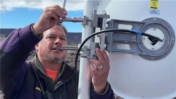
A USGS Hawaiian Volcano Observatory field engineer installs a new antenna at the monitoring station located just southwest of Moku‘āweoweo, where the MOcam and SPcam are located. At this location, field engineers changed the batteries, upgraded the antenna, changed the solar panels, upgraded the MOcam and SPcam, and installed a new thermal webcam that looks down the Southwest Rift Zone—the MSTcam. USGS photo by M. Patrick.
Sources/Usage: Public Domain. View Media Details
Media
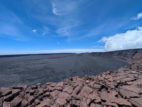
A view of Moku‘āweoweo, the summit caldera of Mauna Loa, taken from the north rim on August 12, 2025.
Sources/Usage: Public Domain. View Media Details
The MSTcam image and 24-hour animated GIF are available to view here: [MSTcam] South Pit and Upper Southwest Rift Zone - thermal image from Moku‘āweoweo south rim | U.S. Geological Survey
View all Mauna Loa webcams here: Webcams | U.S. Geological Survey