
Latest in Landsat November 2025 - Vol. 4 | Issue 9
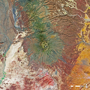
Glaciers and Fjords in Northern Greenland
Landsat Helps Us to See High Latitude Regions
Recent Landsat News
-
Landsat 9 Returns to Normal Operations Following Brief Safehold Landsat 9 Returns to Normal Operations Following Brief Safehold
Landsat 9’s image collection was briefly interrupted in October after a sensor monitoring the position of the solar array began sending noisy data, triggering the satellite to enter safe mode.
Do you know Yellowstone?
Listen in to this new podcast to learn how Landsat satellites help scientists monitor the thermal features of Yellowstone National Park.
-
-
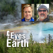
Eyes on Earth Episode 137 – Landsat Takes Yellowstone’s Temperature
The Yellowstone National Park area has more than 10,000 thermal features. And while Old Faithful is a pretty predictable geyser, some thermal features can change quite a bit. New ones can even pop up! Remote sensing provides a tool for monitoring them—especially the thermal infrared sensors (TIRS) on Landsat 8 and Landsat 9 satellites. In this episode of Eyes on Earth, R. Greg Vaughan, the remote...
-
Citing Landsat Products
Landsat products and images created from Landsat data are in the public domain and may be used without any restrictions — however, it is always good to provide a citation to ensure scientific transparency and reproducibility to help track product and/or image impact.

Citation statements for Landsat products are now visible at the top of each product-specific webpage. These webpages are linked from the main Landsat Collection 2 webpage.
The citations for the Landsat Level-2 Surface Reflectance products are listed below to serve as an example of how they are formatted.
There are no restrictions on the use of Landsat products. Please cite the appropriate Landsat Level-2 datasets in the following manner:
- Earth Resources Observation and Science (EROS) Center. (2020). Landsat 8-9 Operational Land Imager / Thermal Infrared Sensor Level-2, Collection 2 [dataset]. U.S. Geological Survey. https://doi.org/10.5066/P9OGBGM6.
- Earth Resources Observation and Science (EROS) Center. (2020). Landsat 7 Enhanced Thematic Mapper Plus Level-2, Collection 2 [dataset]. U.S. Geological Survey. https://doi.org/10.5066/P9C7I13B.
- Earth Resources Observation and Science (EROS) Center. (2020). Landsat 4-5 Thematic Mapper Level-2, Collection 2 [dataset]. U.S. Geological Survey. https://doi.org/10.5066/P9IAXOVV.
When you use Landsat images for outreach, publication, or social media purposes, the following credit can be used to acknowledge the USGS: Landsat Collection 2 Level-2 image courtesy of the U.S. Geological Survey.
Please contact USGS EROS User Services with any questions about citing Landsat products and images.
JACIE 2026 Workshop Call for Abstracts Deadline
The Joint Agency Commercial Imagery Evaluation (JACIE) 2026 Workshop will be held April 13–17, 2026, at USGS Headquarters in Reston, Virginia.
The event is free and open to all registrants. Abstracts for posters or presentations and exhibitor applications can be submitted until December 19, 2025, on the JACIE 2026 Workshop webpage.
JACIE workshops are sponsored by government agencies and provide an opportunity for attendees to present research and learn about new earth observation systems and sensors, new methods of improving data, and the potential for new applications.
JACIE works to leverage resources from several Federal agencies for the characterization of remote sensing data and to share those results across the remote sensing community.
Got Questions? We’ve Got Answers!
-

Landsat Frequently Asked Questions Landsat Frequently Asked Questions
This page lists commonly asked questions pertaining to the Landsat satellite missions, the science behind maintaining high quality Landsat data, and what products are available - and how to download them.
-
Landsat Glossary and Acronyms Landsat Glossary and Acronyms
The Landsat project uses many technical terms and acronyms to describe the satellite systems, sensors, and data formats. This information is vital for interpreting satellite imagery and using Landsat data in research and environmental monitoring. Access this information to locate the terms to learn more!
-

Connect Connect
Access the information on this page to learn more about Landsat, access our social media platforms, or contact us with questions you have about the Landsat missions, the available science products, and how to access Landsat data!
Keep up to date with the Latest in Landsat newsletter
Direct to your inbox! Landsat's monthly newsletter features current news, uses, tools, and announcements about America's Earth-observing satellite program.
The Landsat Program is a joint effort of the U.S. Geological Survey (USGS) and the National Aeronautics and Space Administration (NASA). This partnership creates the unprecedented, continuous record of changes to the Earth's surface worldwide.