Latest in Landsat September 2024 - Vol. 3 | Issue 9
The Landsat Next mission continues to garner international support. The USGS announces another partnership. Also in this issue, you'll find a podcast highlighting the benefits and advancing science of the upcoming Landsat Next mission, learn about working with Landsat data in the commercial cloud, and find links that lead to interesting and helpful applications.
USGS and Australia formally partner for upcoming Landsat Next satellite mission

For nearly half a century the USGS and Geoscience Australia have worked together in Earth Observation science to address complex global challenges and advance shared priorities, including climate change resilience, sustainable development, and opportunities to maximize shared economic prosperity for both nations’ citizens and the global community.
In August, U.S. Secretary of State Antony Blinken and Australian Foreign Minister Penny Wong (pictured here) signed a joint Communique bilateral statement during the Australia-US Ministerial Consultations (AUSMIN), officially joining Australia to the Landsat Next Earth observation mission.
The opportunity to partner comes from the Landsat 2030 International Partnership Initiative, which was announced during the December 2023 U.S. National Space Council meeting. It is designed to enhance U.S. and partner governments’ abilities to sustainably manage their land, surface water and resource use.
Access this USGS Featured Story to read the entire article, and check out related Landsat Next information below.
USGS and Germany signal continued partnership for Landsat Next mission
The U.S. Geological Survey and German Aerospace Center (Deutsches Zentrum für Luft-und Raumfahrt or DLR) signed a statement this month for plans to continue partnership with the upcoming Landsat Next satellite mission.
Landsat Next
The FY 2026 President’s Budget restructures the Landsat Next mission. The USGS and the National Aeronautics and Space Administration (NASA) will work together to identify more affordable approaches to ensuring the continuity of Landsat data for users.
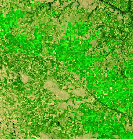
Tarrabool Lake is a seasonal lake in Australia’s Northern Territory
Image acquired by Landsat 8 on August 27, 2024
Landsat Commercial Cloud Data Access
Landsat Collection 2 data can be accessed from the Amazon Web Services (AWS) cloud platform. Leveraging the data storage and processing capabilities that cloud services provide offers new ways to explore the growing record of Landsat observations.
Landsat Archive Dashboard
This interactive dashboard allows you to explore and examine the vast USGS EROS archive of Landsat Collection 2 Level-1 and Level-2 products.
How Do You Landsat
This story contains examples of regional and global projects that utilize Landsat data to assist policymakers and land managers in making informed decisions about our environment and Earth’s natural resources.
Your Name in Landsat - Make Your Own!
Our colleagues at NASA Landsat Communications recently unveiled an interactive application that displays letters in Landsat images!
From over 400 miles in space, the sensors on Landsat satellites acquire imagery that is not only used for science investigations, but also allows for creativity, like seeing the alphabet! See what your name looks like in Landsat imagery by trying out the "Your Name in Landsat" application for yourself!

What's Happening at USGS EROS?

Keep up on the latest news coming out of the USGS Earth Resources Observation and Science (EROS) Center!
Read stories that answer unique questions such as "How are french fries and drinking water connected?" or meet student interns taking their first step toward learning more about what happens at EROS. Listen to new podcasts and see newly added images that show the changes to the Earth's surface over time.
The USGS EROS Center Quarterly Newsletter has this and more — subscribe today!
DYK? You can visit USGS EROS!
Home to one of the largest civilian archives of land images in the world, USGS EROS is open to tours on weekdays. EROS is open Monday through Friday excluding Federal holidays, from 8 a.m. to 4 p.m. Staff-guided tours are available at 10 a.m. and 2 p.m. Self-guided tours are welcome anytime. Group tours and larger gatherings are welcome with notice.
Visit the USGS EROS webpage to learn more and plan your visit soon!
Do you have questions about Landsat?
-
Connect Connect
Access the information on this page to learn more about Landsat, access our social media platforms, or contact us with questions you have about the Landsat missions, the available science products, and how to access Landsat data!


