
In the past, users spent 80% of their time downloading and preparing Landsat data to be processed. With Landsat in the cloud, you can get direct access to stream the Landsat archive without the need to download large amounts of files, by leveraging the Cloud Optimized Geotiff, or "COG".
Landsat Commercial Cloud Data Access
How to Access and Process Landsat Data In the Cloud
A new webinar will help you figure it out!
A new webinar will help you figure it out!
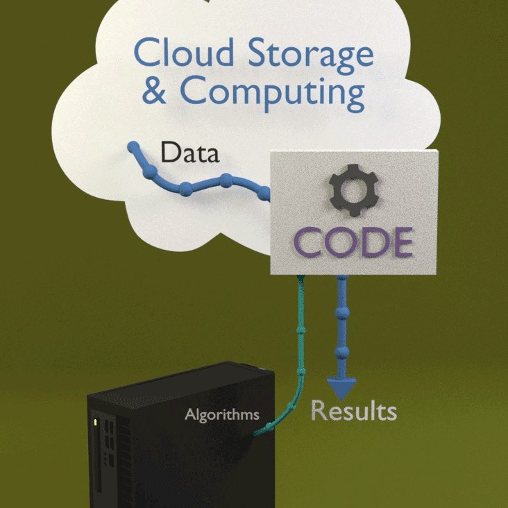
Landsat Collection 2 data can be accessed from the Amazon Web Services (AWS) cloud platform. Leveraging the data storage and processing capabilities that cloud services provide offers new ways to explore the growing record of Landsat observations.
Landsat In the Cloud
Landsat In the Cloud
Presented in April 2025, this webinar can help you work with Landsat data in the commercial cloud environment.
Tutorials
Tutorials
Find help on accessing and processing Landsat data in the cloud. Start Here!
Return to Landsat Data Access Overview
Landsat Collection 2 Level-1 data, Level-2 and Level-3 scene-based products, and Landsat U.S. Analysis Ready Data (ARD) are located in an Amazon Simple Storage Service (S3) s3://usgs-landsat requester pays bucket within the Oregon us-west-2 region. (Note: this capability does not change existing user data access or workflows.)
SpatioTemporal Asset Catalog (STAC)
All Landsat data stored in the AWS cloud platform include SpatioTemporal Asset Catalog (STAC) metadata. Key features of STAC metadata include:
- Interoperability between satellite metadata (e.g., Landsat 8 + Sentinel 2 instruments)
- Exposes data in a common, machine-readable JavaScript Object Notation (JSON) format for both end users and internal processes
- Includes direct links to Amazon Simple Storage Service (S3) objects
- Provides the ability to quickly search large collections of data using spatial and temporal areas of interest
- Lives alongside product-level metadata (Landsat Metadata (MTL), Extensible Markup Language (XML)
Visit the STAC webpage to learn more.
Simple Notification Service (SNS) Topic
The following Amazon Resource Names (ARN) are for Amazon SNS topics that provide notifications whenever a new Landsat products have been added to Landsat on AWS: Learn more about subscribing to SNS topics
Effective June 27, 2023, new SNS topics are available:
- arn:aws:sns:us-west-2:673253540267:public-c2-notify-v2 (Level-1 and Level-2 Scenes)
- arn:aws:sns:us-west-2:673253540267:public-c2-level-3-tile-notify-v2 (Level 3 Science Products)
- arn:aws:sns:us-west-2:673253540267:public-c2-ard-tile-notify-v2 (U.S. ARD Tiles)
- Each SNS topic publishes an Amazon S3 event message whenever a scene-level or product-level index.html file has been created, which is the last step in the process to make data available on Amazon S3. It will only accept subscriptions via Amazon SQS or AWS Lambda.
Documentation
The Landsat Commercial Cloud Direct Access Users Guide provides basic information on how users leverage the Landsat data in the cloud in order to enhance existing workflows by utilizing common tools available in the commercial cloud environment.
Tutorials
A number of tutorials have been established to help users better utilize Landsat data. The majority of them can be found at the USGS repository: https://code.usgs.gov/eros-user-services.
Related

Landsat in the Cloud: COGs and Notebooks
In the past, users spent 80% of their time downloading and preparing Landsat data to be processed. With Landsat in the cloud, you can get direct access to stream the Landsat archive without the need to download large amounts of files, by leveraging the Cloud Optimized Geotiff, or "COG".

Landsat in the Cloud: Will my workflow be supported?
Landsat in the Cloud: Will my workflow be supported?Will my existing workflow still be supported? Landsat downloads will continue to be available via EarthExplorer, LandsatLook, and other familiar USGS tools as they are today, without a noticeable difference to the user. The Landsat record will also remain free and open, with downloads available at no charge to the user.

Landsat Data in the Cloud
The Landsat series of Earth-observing satellites has been continuously acquiring land surface imagery since 1972. Over 10 million Landsat scenes are currently available for download. They are also accessible from a cloud environment, in a cloud optimized format that gives you more flexible, customized access.
The Landsat series of Earth-observing satellites has been continuously acquiring land surface imagery since 1972. Over 10 million Landsat scenes are currently available for download. They are also accessible from a cloud environment, in a cloud optimized format that gives you more flexible, customized access.
Related
Landsat in the Cloud: COGs and Notebooks
In the past, users spent 80% of their time downloading and preparing Landsat data to be processed. With Landsat in the cloud, you can get direct access to stream the Landsat archive without the need to download large amounts of files, by leveraging the Cloud Optimized Geotiff, or "COG".
In the past, users spent 80% of their time downloading and preparing Landsat data to be processed. With Landsat in the cloud, you can get direct access to stream the Landsat archive without the need to download large amounts of files, by leveraging the Cloud Optimized Geotiff, or "COG".
Landsat in the Cloud: Will my workflow be supported?
Landsat in the Cloud: Will my workflow be supported?Will my existing workflow still be supported? Landsat downloads will continue to be available via EarthExplorer, LandsatLook, and other familiar USGS tools as they are today, without a noticeable difference to the user. The Landsat record will also remain free and open, with downloads available at no charge to the user.
Landsat Data in the Cloud
The Landsat series of Earth-observing satellites has been continuously acquiring land surface imagery since 1972. Over 10 million Landsat scenes are currently available for download. They are also accessible from a cloud environment, in a cloud optimized format that gives you more flexible, customized access.
The Landsat series of Earth-observing satellites has been continuously acquiring land surface imagery since 1972. Over 10 million Landsat scenes are currently available for download. They are also accessible from a cloud environment, in a cloud optimized format that gives you more flexible, customized access.