
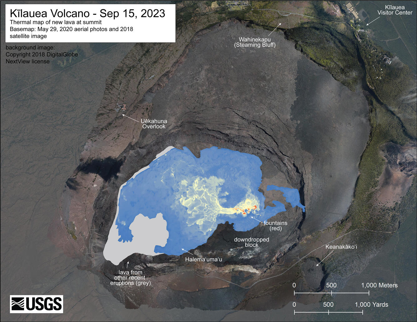
September 15, 2023 — Kīlauea summit thermal maps
September 18, 2023
Media
Sources/Usage: Public Domain. View Media Details
Media

Sources/Usage: Public Domain. View Media Details