
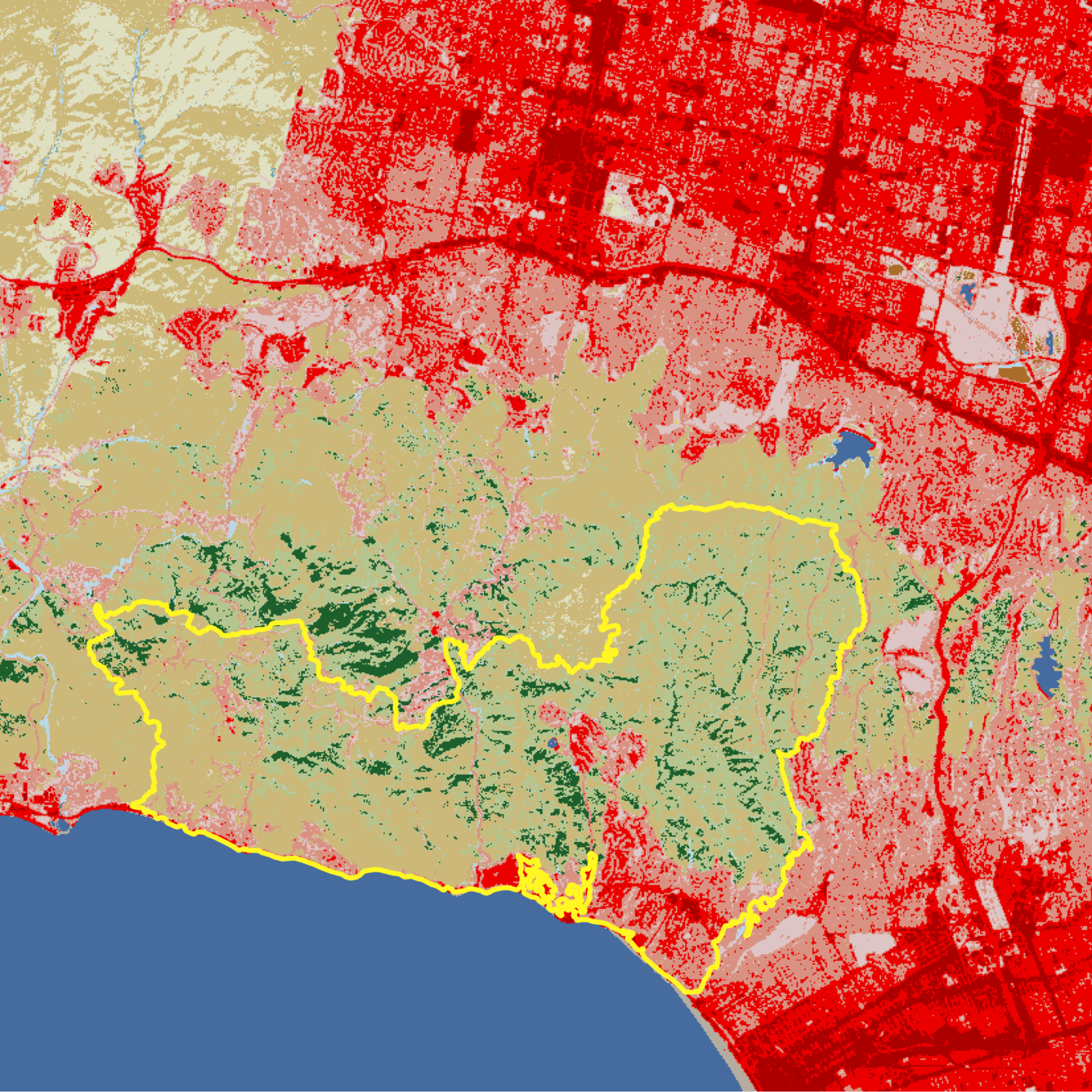
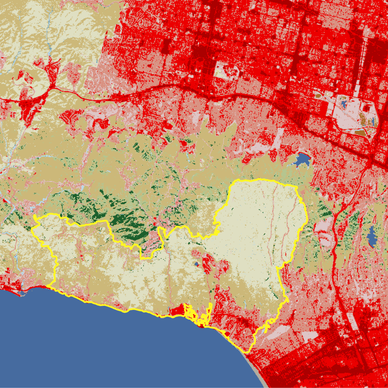
Annual NLCD slider of the Palisades Fire in the Los Angeles area
Annual NLCD is processed using AI/ML techniques.
Annual NLCD is produced using AI/ML techniques
Detailed Description
This Annual National Land Cover Database (NLCD) slider shows before (2024) and after (2025) images of the January 2025 Palisades Fire in the Los Angeles, California, area. The yellow outline represents the fire's perimeter. The light tan color indicates grassland; medium brown is shrub/scrub land cover such as chapparal; dark green is evergreen forest; and shades of red are developed cities and roads, with darker shades indicating more intense areas of development. Dark blue is open water, including the Pacific Ocean at the bottom left. Much of the shrub/scrub and evergreen forest areas within the fire perimeter turned into grassland after the fire.
Sources/Usage
Public Domain.