
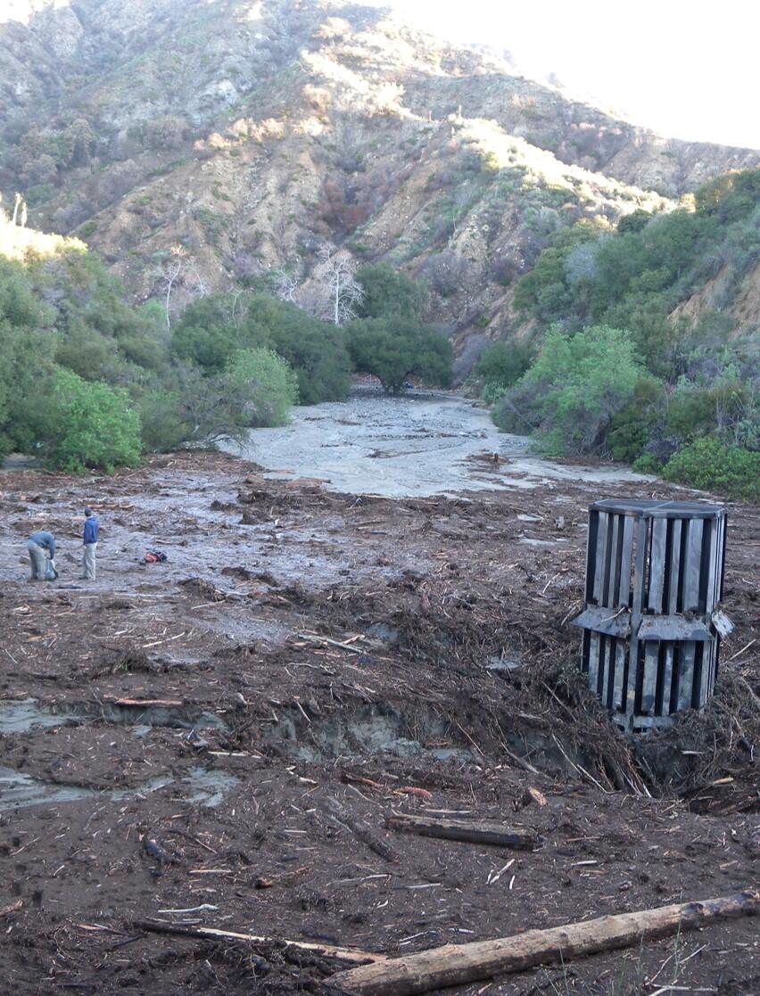
Debris basin Los Angeles County, California before and after a postfire debris flow

Detailed Description
Recently burned slopes are particularly susceptible to flash floods and debris flows from rainfall. Without vegetation to slow down or absorb rain, water can runoff almost instantly, carrying mud, rocks, boulders, and other debris rapidly downslope. Even modest rainstorms can trigger debris flows that move faster than a person can run and can travel beyond the burned area, posing a significant risk to life and property.
In Southern California, debris basins are often built at the outlets of steep watersheds. These basins are made to catch mud, rocks, trees, and other materials that are swept downhill by fast-moving debris floods and flows. By trapping this debris, the basins help protect communities located below areas prone to these dangerous natural hazards.
In 2009, the Station Fire burned over 160,000 acres in the Angeles National Forest, including the steep, rugged terrain of the San Gabriel Mountain Foothills. During the winter that followed, rainstorms triggered debris flows in the Station Fire burn area. One of these major flows filled a debris basin at the mouth of Gould Canyon in Los Angeles County.
Sources/Usage
Public Domain.