
2018 United States Seismic Hazard Model with Photos of Earthquake in Some Locations
Detailed Description
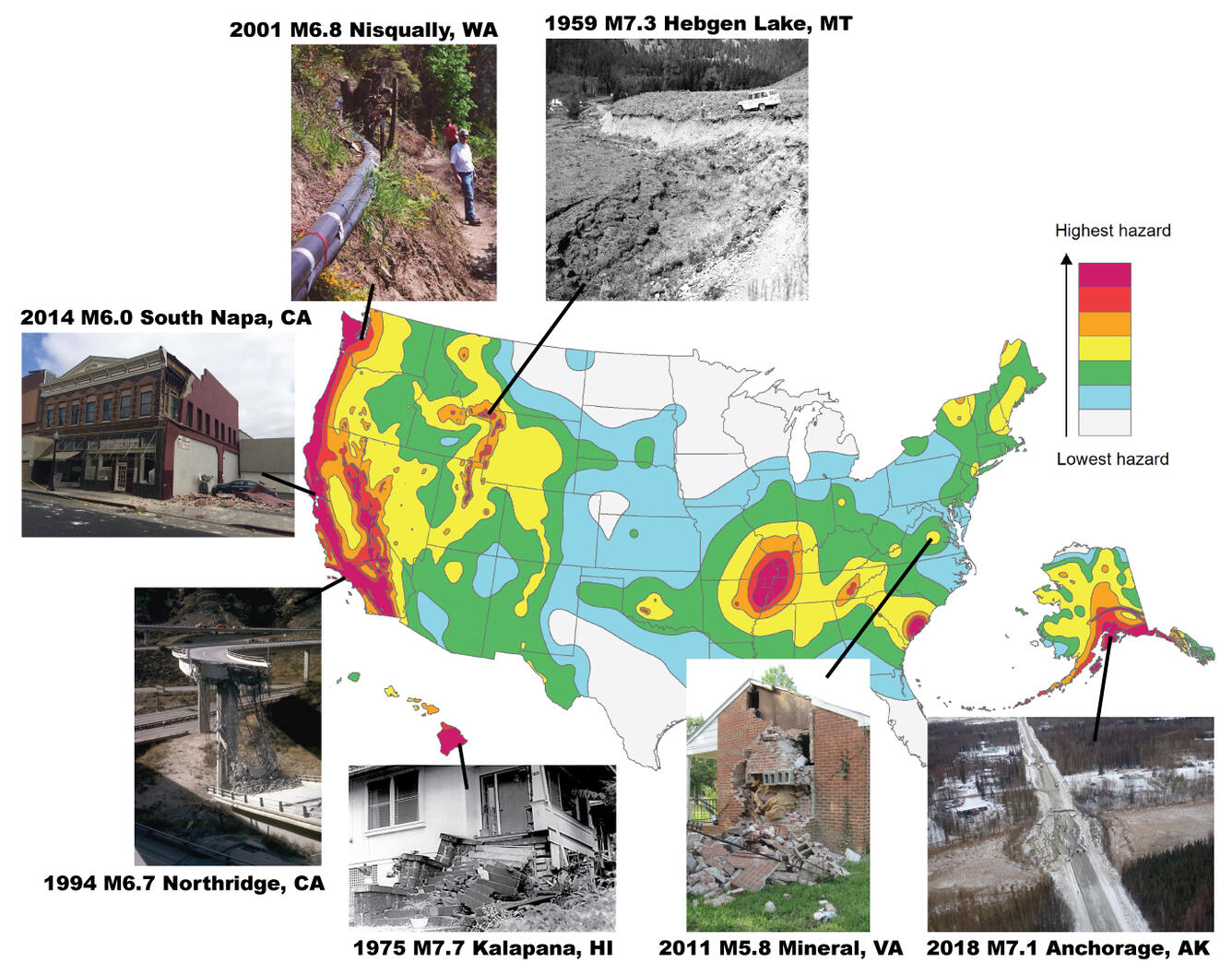
A map from the 2018 United States Seismic Hazard Model showing highest hazard in red and lowest hazard in gray. Damage from various earthquakes around the U.S. is shown in the photographs. Larger versions of each photo can be found at: 2001 M6.8 Nisqually, Washington, 2014 M6.0 South Napa, California, 1994 M6.7 Northridge, California, 1975 M7.7 Kalapani, Hawaii, 2011 M5.8 Mineral, Virginia, and 2018 M7.1 Anchorage, Alaska.
Sources/Usage
Public Domain.
Related

The 2023 National Seismic Hazard Model – What's Shaking?
No one can predict earthquakes. But existing faults and past earthquakes give us information about future earthquakes, and geology tells us how the ground shakes during an earthquake.
Related
The 2023 National Seismic Hazard Model – What's Shaking?
No one can predict earthquakes. But existing faults and past earthquakes give us information about future earthquakes, and geology tells us how the ground shakes during an earthquake.