
3DEP Coverage and Combined Hazards Map
By National Geospatial Program
2018 (approx.)
Detailed Description
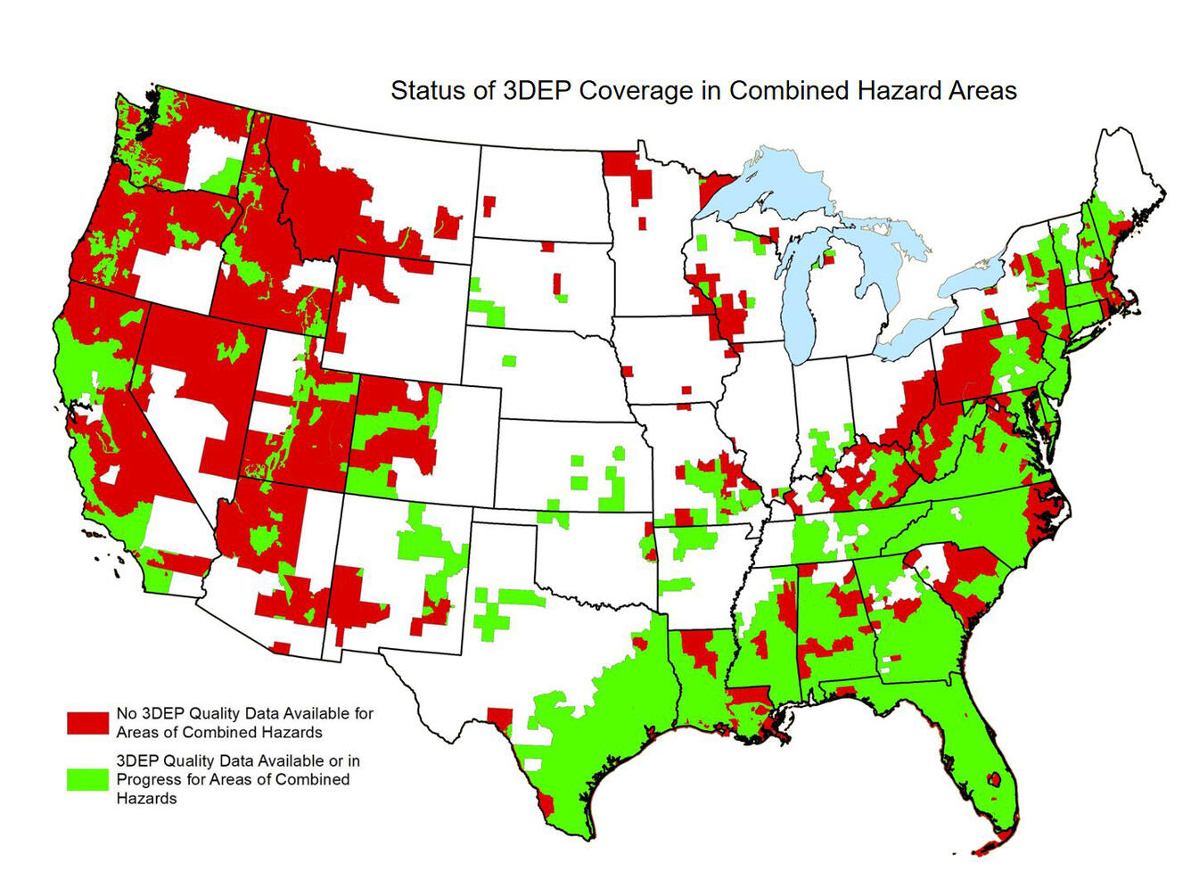
The combined hazards map was produced from the following information:
The 2 highest landslide hazards categories from "Prototype landslide hazard maps of the conterminous United States" by Godt, et al, 2012.
Frequency of 2 or more declared disasters from FEMA Hurricane Disaster Declarations 1964-2014, with Hurricane Irma and Harvey declared areas added.
High and very high wildfire hazard potential from USFS Wildfire Hazard Potential data.
3DEP data are not available in the areas shown in red. The cost to acquire 3DEP data for these areas :
- QL1 – \$374M
- QL2 - \$171M
Sources/Usage
Public Domain.