
A photo of a dirt road.
By Geology and Ecology of National Parks
June 1990 (approx.)
Detailed Description
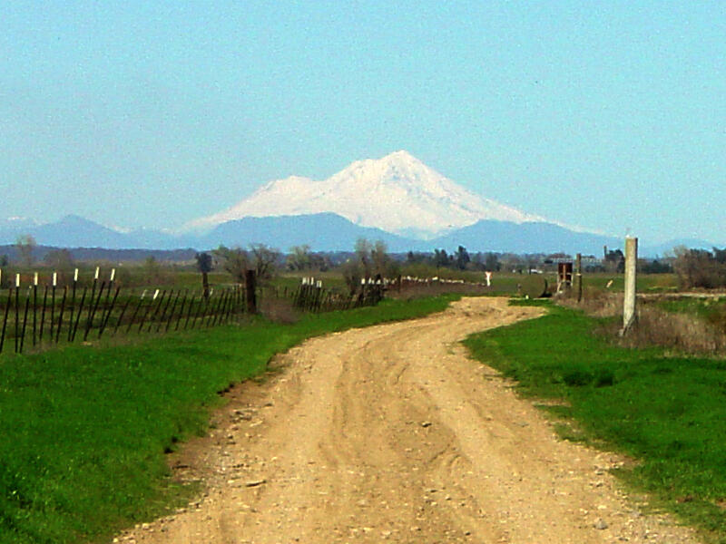
View looking north toward Mt.Shasta (elevation 14,162 feet) from near Redding in the northern Sacramento Valley along Interstate 5. Mount Shasta has an eruptive history from the Pleistocene Epoch extending into the Holocene Epoch. "Mount Shasta has continued to erupt at least once every 600 to 800 years for the last 10,000 years. Its most recent eruption probably was in 1876."(Christiansen, 1990).
Sources/Usage
A photo of a dirt road.