
A photo of a granite boulder
By Geology and Ecology of National Parks
June 2011 (approx.)

Detailed Description
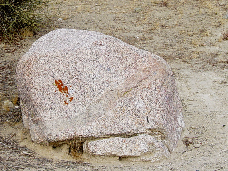
This granitic boulder was eroded from an uplifted range, possibly the San Emigdio Mountains, and then transported and deposited as gravel in a river valley along the San Andreas Fault during the Pleistocene. The band running diagonally across the boulder records the intrusion of younger magma. This is a typical feature of Mesozoic granitic rocks in California.
During the Pleistocene and Pliocene , the Temblor Range and other coastal ranges began to rise and shed sediments into the developing basins along the San Andreas Fault. Since these deposits formed they have been folded and offset by uplift and lateral motion along the San Andreas Fault.
Sources/Usage
A photo of a granite boulder