
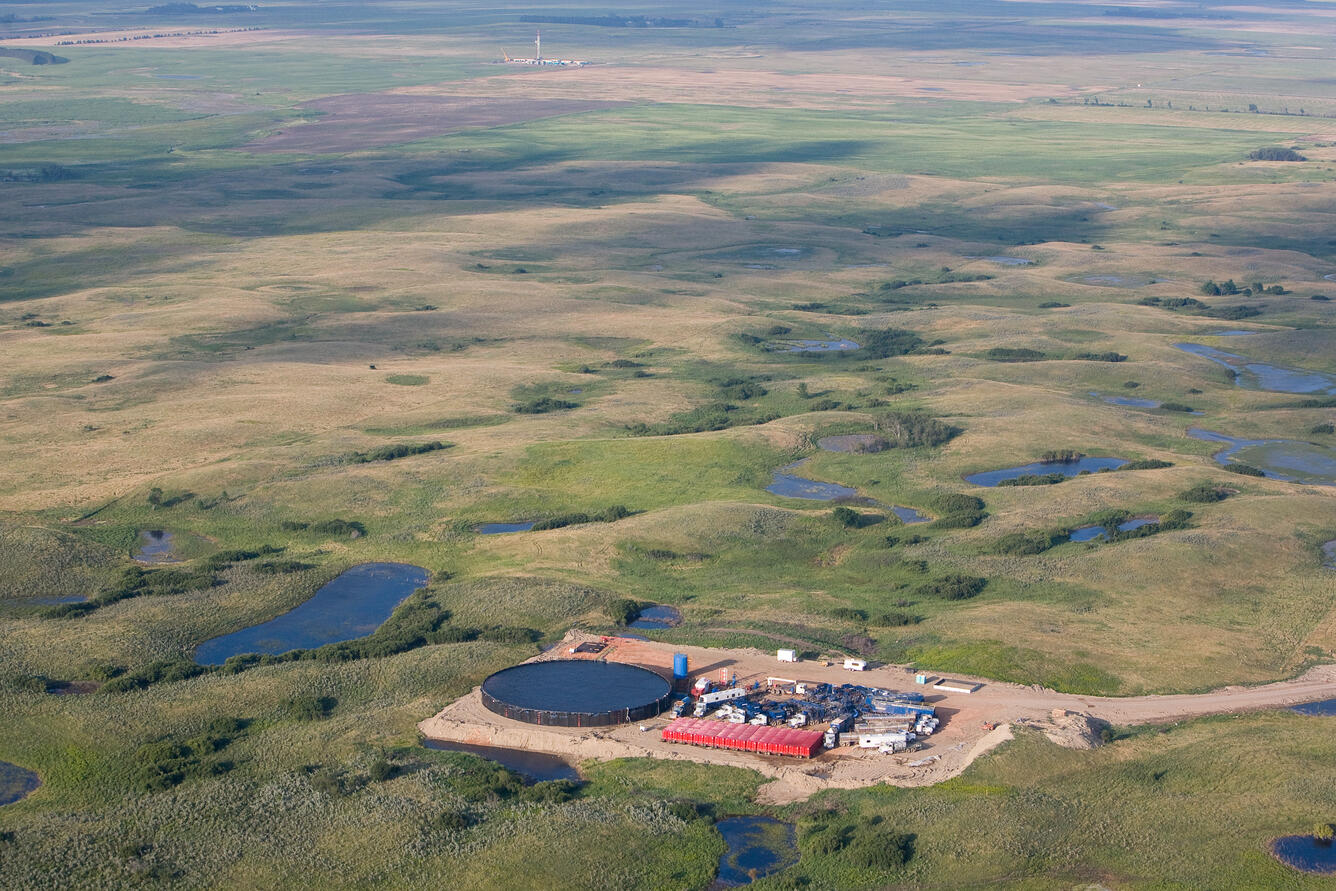
Aerial photograph showing oil and gas development.
By Environmental Health Program
July 2011 (approx.)
Detailed Description
Photograph showing the regional landscape in the Blacktail Creek area, on the edge of the Prairie Potholes Region. The image shows oil and gas development and associated industrial activities along with wetlands typical of the Prairie Potholes region. Photograph by Vern Whitten Photography, used with permission, taken in July of 2011, west of Kenmare, ND. This is used as Figure 1A in the following paper: Geochemical and geophysical indicators of oil and gas wastewater can trace potential exposure pathways following releases to surface waters.
Sources/Usage
With permission from Vern Whitten Photography