
Annual NLCD animation of the Great Salt Lake area from 1985 to 2025
Annual NLCD is produced with AI/ML techniques.
Detailed Description
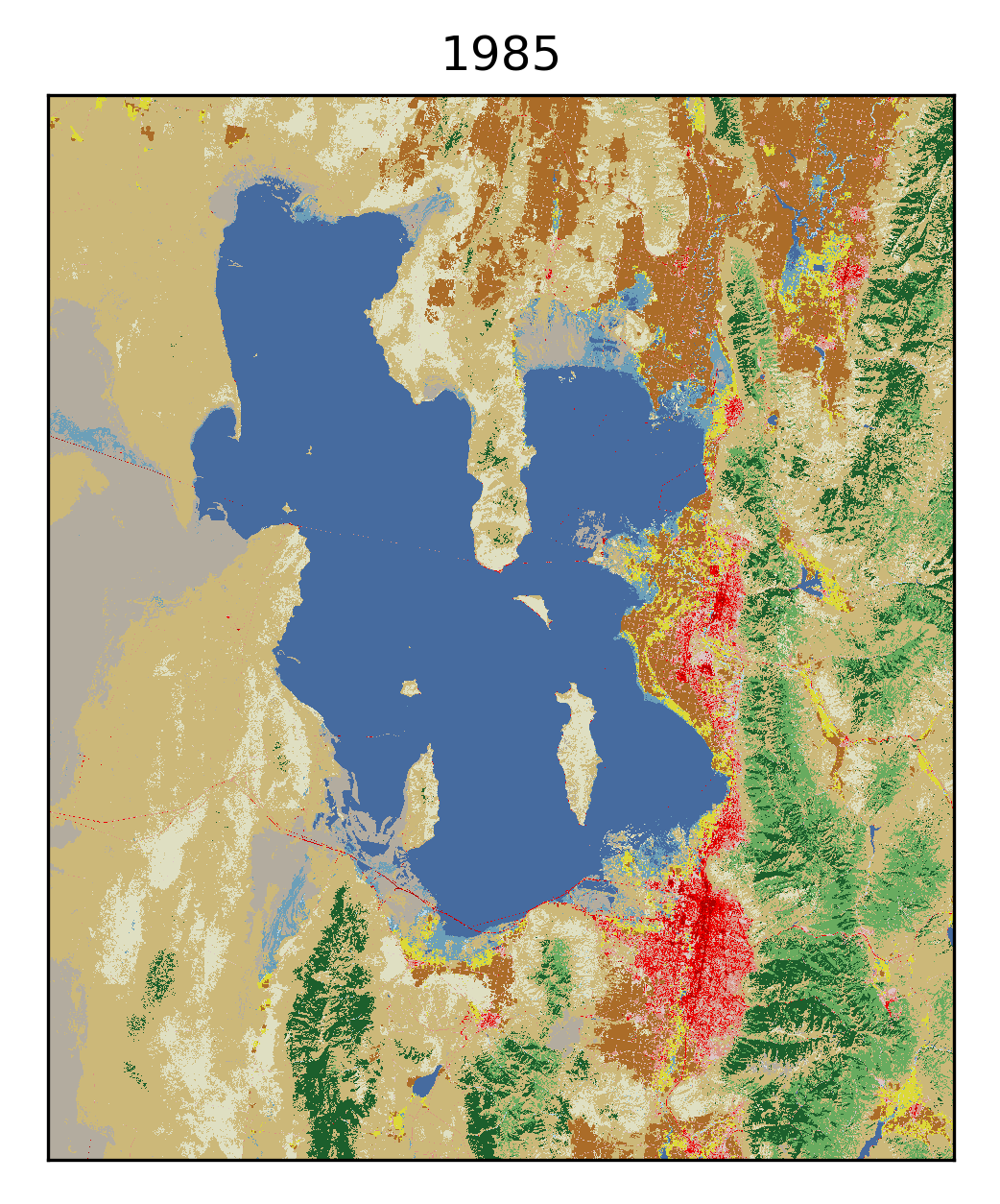
This Annual National Land Cover Database (NLCD) animation shows the Great Salt Lake area in Utah from 1985 to 2025. Darker blue represents open water, while lighter blues represent wetlands. Shades of green signify various types of forests. Shades of red are developed cities and roads, with darker shades indicating more intense areas of development. Light tan is grassland; darker tan is shrub/scrub land cover; yellow is pasture/hay; and brown is cropland. Gray is barren land. During the mid-1980s, the Great Salt Lake's water levels reached historic highs. Since then, water levels have fluctuated year to year but ultimately dwindled. More development has occurred during the animation's time span as well.
Sources/Usage
Public Domain.
Related

About Annual NLCD
Related