
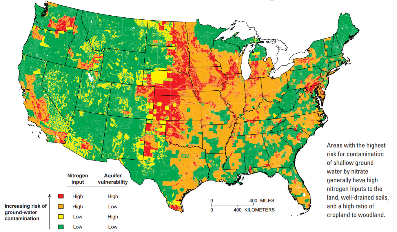
Areas at high risk of nitrogen contamination of groundwater

Detailed Description
Modeling integrates information to estimate risks of nitrate contamination to shallow ground water
One USGS model, based on nationwide data, was developed to estimate the risk of nitrate contamination to shallow ground water across the United States.(30) The model integrates nitrogen inputs and aquifer vulnerability by use of Geographic Information System (GIS) technology. Nitrogen inputs include commercial fertilizer and manure application rates, atmospheric contributions, and population densities (the latter representing residential and urban nitrogen sources, such as septic systems, fertilizers, and domestic animal waste). Aquifer vulnerability is represented by soil-drainage characteristics—the ease with which water and chemicals can seep to ground water—and the extent to which woodlands are interspersed with cropland.
Sources/Usage
Public Domain.
The quality of our nation's waters; nutrients and pesticides
US Geological Survey Circular 1225: The quality of our nation's waters; nutrients and pesticides.
'The quality of our nation's waters,' designed to describe major findings of the National Water-Quality Assessment Program regarding water-quality issues of regional and national concern.
Related

Groundwater Quality

Nitrogen and Water
Related
Groundwater Quality