
Arsenic Concentrations in Fourmile and Boulder Creeks
By Ecosystems Land Change Science Program
April 2020 (approx.)

Detailed Description
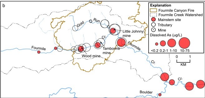
Map of study area showing the average arsenic concentrations in the mainstem of Fourmile and Boulder Creeks after wildfire and flooding. Credit: Sheila Murphy, USGS, adapted from Figure 7 in Murphy et al. (2020).
Sources/Usage
Public Domain.