



Paleoscience for Partners: Reconstructing the Past to Prepare for the Future
The Earth in Flux Chart Gallery
A shared initiative between the USGS Water Mission Area and Ecosystems Mission Area to communicate key findings of USGS land change science in innovative ways, and to encourage creativity, exploration, and community in data visualization.
A shared initiative between the USGS Water Mission Area and Ecosystems Mission Area to communicate key findings of USGS land change science in innovative ways, and to encourage creativity, exploration, and community in data visualization.
Coring Expedition to Palmyra Atoll
Helping managers understand pre-human vegetation, climate variability, and sea level changes
Helping managers understand pre-human vegetation, climate variability, and sea level changes
National News Release: Study confirms age of oldest fossil human footprints in North America
Two new lines of evidence support the 21,000 to 23,000-year age estimate of the footprints first described and dated in 2021
Two new lines of evidence support the 21,000 to 23,000-year age estimate of the footprints first described and dated in 2021
The Glacier - Climate Connection
The story of the U.S. Geological Survey Benchmark Glacier Project, one of the longest running studies of glaciers on Earth
The story of the U.S. Geological Survey Benchmark Glacier Project, one of the longest running studies of glaciers on Earth
The National Climate Change Viewer (NCCV)
A tool that helps land managers and decision makers plan for climate change
A tool that helps land managers and decision makers plan for climate change
Ecosystems Land Change Science Program
The Land Change Science Program in the USGS Ecosystems Mission Area strives to advance the understanding of the physical, chemical, and biological components of the Earth system, the causes and consequences of ecosystem and land use change, and the vulnerability and resilience of the Earth system to such changes.


News
The Slime Trail: How USGS eDNA Efforts Are Revealing What Lives in the Deep Gulf
The Slime Trail: How USGS eDNA Efforts Are Revealing What Lives in the Deep Gulf
FORT Updates: From Plains to Peaks - Vol. 4 | Issue 3
FORT Updates: From Plains to Peaks - Vol. 4 | Issue 3
A Pristine Headwaters Ecosystem as an Outdoor Laboratory for Foundational Science
A Pristine Headwaters Ecosystem as an Outdoor Laboratory for Foundational Science
Publications
On the fidelity of oxygen isotope-based sea level reconstructions: A case study of Marine Isotope Stage 3 On the fidelity of oxygen isotope-based sea level reconstructions: A case study of Marine Isotope Stage 3
Although foraminiferal oxygen isotope records (δ18OF) have long been used to develop time-continuous estimates of past global ice volume, growing evidence indicates that the ice volume and temperature contributions to δ18OF diverge considerably over the last glacial cycle. Across Marine Isotope Stage 3 (MIS 3; 57 to 29 ka), estimates of peak global sea level based on δ18OF are ∼30 m...
Probabilistic forecasting of coastal wetland elevation and soil carbon response to sea-level rise Probabilistic forecasting of coastal wetland elevation and soil carbon response to sea-level rise
Tidal wetlands build soil as a dynamic response to inundation, resulting in carbon sequestration and resilience to sea-level rise. Process models can be used to make site-specific forecasts, anticipate future changes, and plan management responses. But to be actionable, forecasts from these models need to be accompanied by descriptions of their confidence. In this study, we demonstrate...
Microfocus X-ray computed tomography to evaluate ostracode shell density and other metrics for monitoring ocean acidification in the Arctic Ocean Microfocus X-ray computed tomography to evaluate ostracode shell density and other metrics for monitoring ocean acidification in the Arctic Ocean
Ocean acidification (OA) poses a significant threat to the ability of marine calcifying organisms—such as mollusks, corals, crustaceans, and plankton—to form and maintain their calcium carbonate-based shells. While some species show greater sensitivity to OA than others, the impacts on benthic marine calcifiers remain inadequately understood. This study investigates the shell density...
Science

Wolverine Glacier
Wolverine Glacier is located in Alaska’s Kenai Mountains, along the western flank of Prince William Sound. Glacier observations began in 1966 and continue through present as the western most USGS Benchmark Glacier.
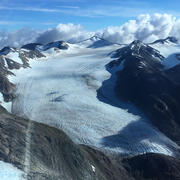
Lemon Creek Glacier
Lemon Creek Glacier is located in southeast Alaska, at the southernmost tip of the Juneau Icefield. Glacier observations began at this site in 1953 and continue through present, serving as a central site between glaciers in the contiguous USA and those in mainland Alaska.

Gulkana Glacier
Gulkana Glacier is located in the high-latitude continental climate regime of Alaska’s Delta Mountains. Glacier observations began at this site in 1966 and continue through present as the northern most USGS Benchmark Glacier.