
Attachment C: FY16 Consolidated Federal Areas of Interest
Detailed Description
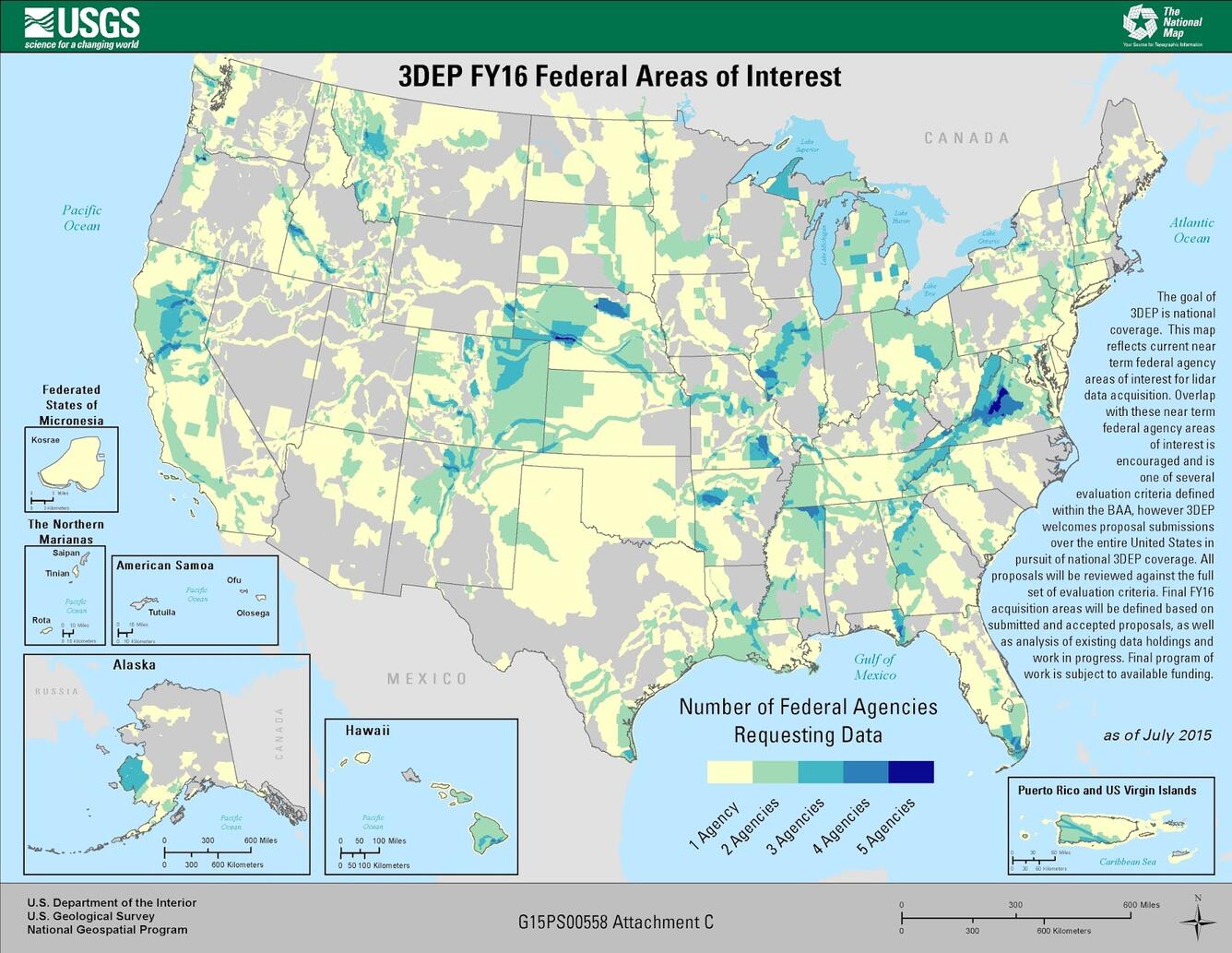
Map Title: 3DEP FY16 Federal Areas of Interest
The goal of 3DEP is national coverage. This map reflects current near-term federal agency areas of interest for lidar data acquisition in the United States and Territories. Overlap with these near term federal agency areas of interest is encouraged and is one of several evaluation criteria defined within the BAA, however 3DEP welcomes proposal submissions over the entire United States in pursuit of national 3DEP coverage. All proposals will be reviewed against the full set of evaluation criteria. Final FY16 acquisition areas will be defined based on submitted and accepted proposals, as well as analysis of existing data holdings and work in progress. Final program of work is subject to available funding.
Legend Key (Colors left to right)
1 agency, 2 agencies, 3 agencies, 4 agencies, 5 agencies
Sources/Usage
Public Domain.
Broad Agency Announcements (BAAs)
The USGS issues a Broad Agency Announcement (BAA) that provides detailed information on how to partner with the USGS and other Federal agencies to acquire high-quality 3D data. Past BAA information may be found on the general BAA webpage.
FY15/16 Consolidated Federal Areas of Interest