
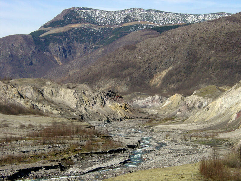
Badlands along Toutle River
Detailed Description
This zoomed-in view down the Toutle River Valley shows more detail of the stream channel and bluffs along the river. The image also shows the patchy character of the remaining forests in the boundary zone affected by the blast of the May 18th, 1980 eruption of the volcano.
Sources/Usage
Public Domain.