
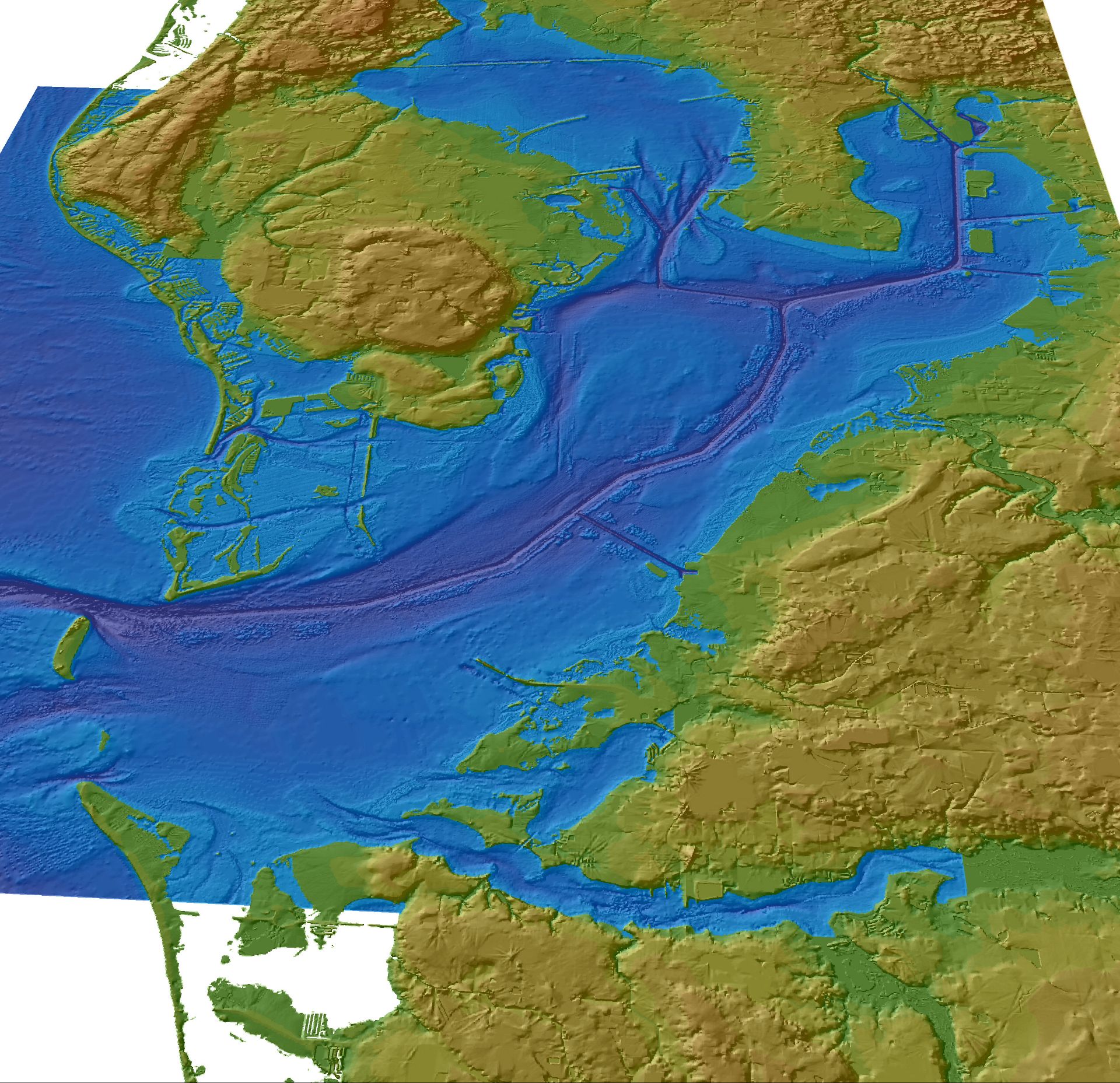
Bathymetric map of Tampa Bay

Detailed Description
A map of high-resolution bathymetric data from Tampa Bay was created to support the development of hydrodynamic and sediment-transport models. Dean Tyler of the USGS Center for Earth Resources Observation and Science (EROS) created the map by merging many disparate data sets. All of the topographic data come from the USGS National Elevation Dataset (NED) and much of the bathymetric data from NOAA's GEOphysical DAta System (GEODAS). For most of the nearshore areas around the bay, GEODAS data were replaced with higher-resolution bathymetric data acquired in 2003 and 2004 with NASA Experimental Advanced Airborne Research Lidar (EAARL). Efforts like these advance technical mapping capabilities and harness important collaborations both within USGS and with partners.
Sources/Usage
Public Domain.