
Breach in Eastern Berm of Jim Foot Key, Florida
Detailed Description
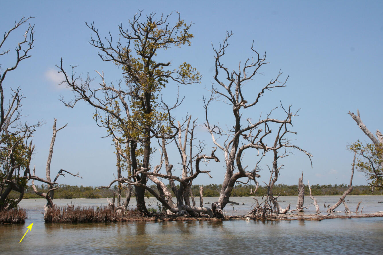
In Photo: Eastern berm of Jim Foot Key, April 2019. This photo taken from Florida Bay, looking in toward the center of the island (now covered in water). The arrow points toward a breach in the berm, first noted in 2014, but the cut has deepened significantly after Hurricane Irma, and the island interior appears to be permanently tidal. Loss of the berm structure is indicated by the presence of water on top of the flattened berm on the right side of the image.
Scientists from the Florence Bascom Geoscience Center first sampled four islands in Florida Bay, Everglades National Park, in April 2014 to collect cores to study sea level rise and storm history in the region. In September 2017, Hurricane Irma (a category 4 storm at landfall in the Florida Keys) passed just to the west of our field sites. The western-most of the four islands (Jim Foot Key) was closest to the eye of the storm and the most impacted.
Islands such as Jim Foot Key serve as examples of what might happen to the main-land coast of Florida with changes in sea level and climate. Observations through summer 2018 have been published but the research team continues to monitor Jim Foot Key to see if the protective berm will recover or if the eastern part of the island will be inundated by rising sea level.
Sources/Usage
Public Domain.